East Borough, Wimborne, west side - Hartlands (detail)
Introduction
The photograph on this page of East Borough, Wimborne, west side - Hartlands (detail) by Mike Searle as part of the Geograph project.
The Geograph project started in 2005 with the aim of publishing, organising and preserving representative images for every square kilometre of Great Britain, Ireland and the Isle of Man.

There are currently over 7.5m images from over 14,400 individuals and you can help contribute to the project by visiting https://www.geograph.org.uk
East Borough, Wimborne, west side - Hartlands (detail)
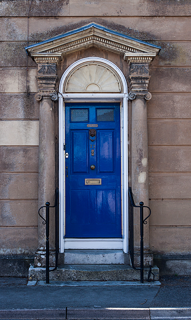
Image: © Mike Searle Taken: 22 Mar 2015
The doorway of Hartlands consists of a 6 panel door in a classical surround, with a broken pediment hood and entablature, with an ornamental frieze and Ionic pilasters.
Images are licensed for reuse under creativecommons.org/licenses/by-sa/2.0
Image Location


Leaflet Map data © OpenStreetMap
Latitude
50.803607
Longitude
-1.987886