Old Toll House by West Borough, Wimborne Minster
Introduction
The photograph on this page of Old Toll House by West Borough, Wimborne Minster by Alan Rosevear as part of the Geograph project.
The Geograph project started in 2005 with the aim of publishing, organising and preserving representative images for every square kilometre of Great Britain, Ireland and the Isle of Man.

There are currently over 7.5m images from over 14,400 individuals and you can help contribute to the project by visiting https://www.geograph.org.uk
Old Toll House by West Borough, Wimborne Minster
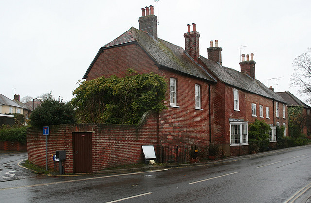
Image: © Alan Rosevear Taken: 10 Nov 2008
Toll House by the B3078, in the parish of Wimborne Minster (East Dorset District), Nos. 46-49, (GR II listed as No.63) West Borough. The centre section with the bay windows is believed to have been the toll house. Grade II listed. List Entry Number: 1304037 https://historicengland.org.uk/listing/the-list/list-entry/1304037 Surveyed Milestone Society National ID: DO.WIM02
Images are licensed for reuse under creativecommons.org/licenses/by-sa/2.0
Image Location


Leaflet Map data © OpenStreetMap
Latitude
50.803427
Longitude
-1.989021