IMAGES TAKEN NEAR TO
Hyde, WAREHAM, BH20 7PJ
Introduction
This page details the photographs taken nearby to BH20 7PJ by members of the Geograph project.
The Geograph project started in 2005 with the aim of publishing, organising and preserving representative images for every square kilometre of Great Britain, Ireland and the Isle of Man.

There are currently over 7.5m images from over14,400 individuals and you can help contribute to the project by visiting https://www.geograph.org.uk
Image Map
Images are licensed for reuse under creativecommons.org/licenses/by-sa/2.0
Notes
- Clicking on the map will re-center to the selected point.
- The higher the marker number, the further away the image location is from the centre of the postcode.
Image Listing (10 Images Found)
Images are licensed for reuse under creativecommons.org/licenses/by-sa/2.0
Image
Details
Distance
1
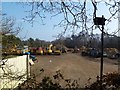
East Stoke, depot
On the site of a disused pit; now used as depot for machinery and aggregates from nearby pits. http://www.andrewsplant.co.uk/index.html
Image: © Mike Faherty
Taken: 1 Mar 2012
0.04 miles

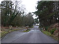
4
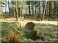
Great Plantation, trench
One of several obstructions at the northern end of Great Plantation; apparently built to deter New Age travellers, who have recently used the site.
Image: © Mike Faherty
Taken: 1 Mar 2012
0.11 miles
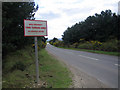
6
Cattle Grid on Higher Hyde Heath
Many of the small roads on the heathland have cattle grids to reduce the movement of stock although none of the gates on any of the grids I went through were actually closed so they are actually used very little.
Image: © Nigel Mykura
Taken: 1 Feb 2013
0.14 miles
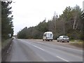
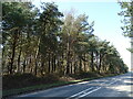
8
Tank turning area near Bovington Camp
Tanks regularly use this road and track marks can be seen on the ground
Image: © John Lamper
Taken: 1 May 2006
0.15 miles
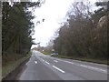
9
Tank turning area near Bovington Camp
Tanks regularly use this road and track marks can be seen along the edge of the opposite side of the road
Image: © John Lamper
Taken: 1 May 2006
0.15 miles
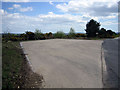
10
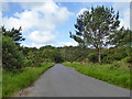
Road, Higher Hyde Heath
Public heathland.
Image: © Robin Webster
Taken: 4 Jun 2017
0.18 miles