
IMAGES TAKEN NEAR TO
Heathgreen Road, SWANAGE, BH19 3BT
Introduction
This page details the photographs taken nearby to Heathgreen Road, BH19 3BT by members of the Geograph project.
The Geograph project started in 2005 with the aim of publishing, organising and preserving representative images for every square kilometre of Great Britain, Ireland and the Isle of Man.

There are currently over 7.5m images from over14,400 individuals and you can help contribute to the project by visiting https://www.geograph.org.uk
Image Map
Images are licensed for reuse under creativecommons.org/licenses/by-sa/2.0
Notes
- Clicking on the map will re-center to the selected point.
- The higher the marker number, the further away the image location is from the centre of the postcode.
Image Listing (221 Images Found)
Images are licensed for reuse under creativecommons.org/licenses/by-sa/2.0
Image
Details
Distance
1
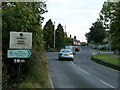
Road signs at Studland
A pre-Worboys sign on the B3351.
Image: © Phil Champion
Taken: 24 Sep 2009
0.01 miles
2

Direction Sign ? Signpost on the B3351 in Studland
Located on the northwest side of the crossroads of School Lane, Heath Green Road and the B3351 Ferry Road / Swanage Road, in Studland parish. 1 arm and annulus & bar finial. Erected after July 2019.
Milestone Society National ID: DO_SZ0382A
Image: © D Dougherty
Taken: 24 Jul 2022
0.03 miles
3
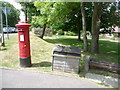
Studland: postbox № BH19 79, Ferry Road
This George VI-reign postbox stands opposite the Image and is emptied finally at 4:30pm on weekdays and at 10:30am on Saturdays – unsurprisingly, the latest times of the four boxes in the village.
Image: © Chris Downer
Taken: 21 Jun 2009
0.03 miles
5
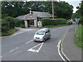
Heath Green Road, Studland
Heath Green Road in the village of Studland in Dorset. In the background is Studland Village Hall.
Image: © Malc McDonald
Taken: 17 Aug 2012
0.03 miles
6
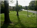
Studland, village green
In various sections; this one is on the Southern side of Heath Green Road.
Image: © Mike Faherty
Taken: 2 May 2009
0.03 miles
7
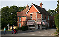
Studland Stores and Post Office
The shop stands on the crossroads in the middle of the village of Studland.
Image: © Anne Burgess
Taken: 2 Jul 2014
0.04 miles
8

Studland: the post office and stores
Studland's post office used to be a little uphill from here, behind camera, but relocated about 10 years ago to within the village shop. Such an arrangement probably helps both the office and the shop to survive.
Image: © Chris Downer
Taken: 21 Jun 2009
0.04 miles
9
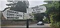
Direction Sign ? Signpost on the B3351 in Studland
Located on a grass triangle in the centre of the junction of the B3351 Ferry Road / Swanage Road and Beach Road, in Studland parish. 3 arms and annulus & bar finial. Erected after July 2019.
Milestone Society National ID: DO_SZ0382B
Image: © D Dougherty
Taken: 24 Jul 2022
0.04 miles
10
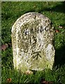
Old Milestone in Studland, B3351 - Beach Road junction
Carved stone post by the UC road, in parish of STUDLAND (PURBECK District), junction of B3351 and road to beach car parks, in centre of grass triangle, on West side of road. Dorset 2 (limestone), erected by the Wareham (North, South & West Branches) turnpike trust in the 19th century.
Inscription reads:-
SWANAGE
3½
Carved benchmark at lower centre of front face.
Milestone Society National ID: DO_SWSL03
Image: © Mike Faherty
Taken: 5 Nov 2006
0.04 miles