
IMAGES TAKEN NEAR TO
West Way, BROADSTONE, BH18 9LL
Introduction
This page details the photographs taken nearby to West Way, BH18 9LL by members of the Geograph project.
The Geograph project started in 2005 with the aim of publishing, organising and preserving representative images for every square kilometre of Great Britain, Ireland and the Isle of Man.

There are currently over 7.5m images from over14,400 individuals and you can help contribute to the project by visiting https://www.geograph.org.uk
Image Map
Images are licensed for reuse under creativecommons.org/licenses/by-sa/2.0
Notes
- Clicking on the map will re-center to the selected point.
- The higher the marker number, the further away the image location is from the centre of the postcode.
Image Listing (8 Images Found)
Images are licensed for reuse under creativecommons.org/licenses/by-sa/2.0
Image
Details
Distance
1
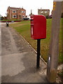
Broadstone: postbox № BH18 175, West Way
This small postbox is emptied finally at 4pm on weekdays and at 11:45am on Saturdays.
Image: © Chris Downer
Taken: 2 Apr 2010
0.07 miles
2
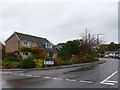
West Way, Broadstone.
West Way is a long straggly residential road snaking through suburban Poole on the southern edge of this grid square. Taken on a cold, grey, wet, windy, November day.
Image: © Nigel Mykura
Taken: 22 Nov 2009
0.09 miles
3
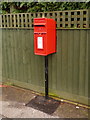
Broadstone: postbox № BH18 210, Lytchett Drive
The square of tarmac at the bottom of this postbox appears to be rather new, while the box has caused a small piece to be cut out of the presumably even newer fence.
The box is emptied finally at 4pm on weekdays and at 11:45am on Saturdays.
Image: © Chris Downer
Taken: 2 Apr 2010
0.15 miles
4
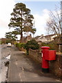
Broadstone: postbox № BH18 173, Corfe Way
An Elizabeth II-reign postbox, with drop box attached (see below), emptied finally at 5:15pm on weekdays and at 11:45am on Saturdays.
Image: © Chris Downer
Taken: 2 Apr 2010
0.18 miles
5
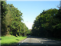
Broadstone Way
Broadstone Way was built on the alignment of the former LSWR line from Broadstone to Bournemouth West. It also carried all the traffic off the southern end of the well-known Somerset & Dorset Joint Railway.
Image: © Peter Kazmierczak
Taken: 28 Oct 2011
0.20 miles
6
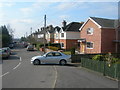
Northbrook Road, Broadstone
Near junction of York Road, photographer facing SSW. In the far distance it is just possible to see the Purbeck Hills.
Image: © Danny P Robinson
Taken: 11 Mar 2006
0.20 miles
7
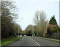
On Broadstone Way
Broadstone Way, laid on the trackbed of the former London & South Western Railway line.
Image: © Peter Kazmierczak
Taken: 29 Feb 2016
0.21 miles
8
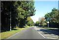
Broadstone Way
This fast road was built on the alignment of the former LSWR line into Bournemouth West from Broadstone.
Image: © Peter Kazmierczak
Taken: 28 Oct 2011
0.24 miles