
IMAGES TAKEN NEAR TO
Birchwood Road, POOLE, BH16 5LE
Introduction
This page details the photographs taken nearby to Birchwood Road, BH16 5LE by members of the Geograph project.
The Geograph project started in 2005 with the aim of publishing, organising and preserving representative images for every square kilometre of Great Britain, Ireland and the Isle of Man.

There are currently over 7.5m images from over14,400 individuals and you can help contribute to the project by visiting https://www.geograph.org.uk
Image Map
Images are licensed for reuse under creativecommons.org/licenses/by-sa/2.0
Notes
- Clicking on the map will re-center to the selected point.
- The higher the marker number, the further away the image location is from the centre of the postcode.
Image Listing (15 Images Found)
Images are licensed for reuse under creativecommons.org/licenses/by-sa/2.0
Image
Details
Distance
1
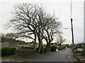
Sandy Lane, Upton, near Poole
Sandy Lane is a minor residential road in Upton, near Poole.
This image was taken on a February afternoon. The trees on the other side of the road were bare for the winter.
Image: © Malc McDonald
Taken: 6 Feb 2022
0.05 miles
2
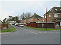
Pearce Road, Upton
Pearce Road is a residential cul-de-sac in Upton, near Poole.
Image: © Malc McDonald
Taken: 6 Feb 2022
0.06 miles
3
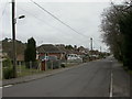
Upton, Sandy Lane
Road running roughly parallel with Dorchester Road, here with 1960s-looking bungalows.
Image: © Mike Faherty
Taken: 27 Feb 2010
0.07 miles
4
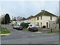
Chelmsford Road, Upton, near Poole
Chelmsford Road is a residential cul-de-sac in Upton, near Poole.
Image: © Malc McDonald
Taken: 6 Feb 2022
0.09 miles
5
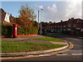
Upton: postbox № BH16 199, Moorland Way
This George VI-reign postbox stands on the corner of Moorland Crescent, along which we are looking, and is emptied finally at 5:30pm on weekdays and at 11am on Saturdays.
Image: © Chris Downer
Taken: 15 Nov 2009
0.12 miles
6
Guest Road, Upton, near Poole
Guest Road is a residential cul-de-sac in Upton, near Poole.
Image: © Malc McDonald
Taken: 6 Feb 2022
0.13 miles
7
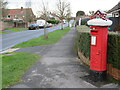
Post box on Moorland Way, Upton, near Poole
A Royal Mail post box on Moorland Way in Upton, near Poole. The post box has been adorned with a knitted topper depicting a gingerbread house.
Image: © Malc McDonald
Taken: 6 Feb 2022
0.13 miles
8
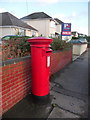
Upton: postbox № BH16 260, Sandy Lane
This Elizabeth II-reign postbox is emptied finally at 5:30pm on weekdays and at 11am on Saturdays.
Image: © Chris Downer
Taken: 15 Nov 2009
0.16 miles
9
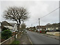
Sandy Lane, Upton, near Poole
Sandy Lane is a minor residential road in Upton, near Poole.
This image was taken on a dull February day. The tree to the left of the road was bare for the winter.
Image: © Malc McDonald
Taken: 6 Feb 2022
0.17 miles
10
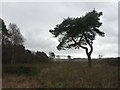
Upton, nature reserve
Reserve and open access land managed by Herpetelogical Conservation Trust; woodland, scrub, heather and grassland; looking South towards Lychett Bay. Shown on this map as Lytchett Heath: http://www.herpconstrust.org.uk/dorset_reserves.htm
Image: © Mike Faherty
Taken: 27 Feb 2010
0.17 miles