
IMAGES TAKEN NEAR TO
Brunstead Road, POOLE, BH12 1EJ
Introduction
This page details the photographs taken nearby to Brunstead Road, BH12 1EJ by members of the Geograph project.
The Geograph project started in 2005 with the aim of publishing, organising and preserving representative images for every square kilometre of Great Britain, Ireland and the Isle of Man.

There are currently over 7.5m images from over14,400 individuals and you can help contribute to the project by visiting https://www.geograph.org.uk
Image Map
Images are licensed for reuse under creativecommons.org/licenses/by-sa/2.0
Notes
- Clicking on the map will re-center to the selected point.
- The higher the marker number, the further away the image location is from the centre of the postcode.
Image Listing (85 Images Found)
Images are licensed for reuse under creativecommons.org/licenses/by-sa/2.0
Image
Details
Distance
1
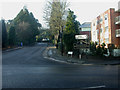
Branksome, boundary post
At the junction of Surrey & Brunstead Roads, though the actual boundary is some way to the east. Local authorities have adopted this pattern of boundary post, with undulating top; perhaps supposed to be redolent of the sea.
Image: © Mike Faherty
Taken: 9 Jan 2009
0.06 miles
2
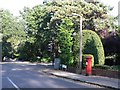
Branksome: postbox № BH12 240, Brunstead Road
An Elizabeth II-reign postbox close to the Surrey Road traffic lights. Branksome Wood Road is the road across the other side of the junction.
Image: © Chris Downer
Taken: 20 Sep 2008
0.06 miles
3
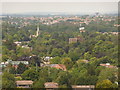
Branksome: St. John?s from the Bournemouth balloon
Looking down from Image across the treetops to the northwest of Bournemouth town centre. Just across the border into the borough of Poole is Image whose spire we see, left. In the distance is Image at the northern extremity of Image
Image: © Chris Downer
Taken: 21 Jun 2010
0.07 miles
4
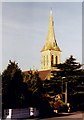
St John the Evangelist, Surrey Road, Bournemouth
Built in 1889. The Church stands just inside the Poole border but serves a Bournemouth Parish.
Image: © Michael FORD
Taken: Unknown
0.08 miles
5
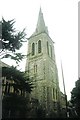
Bournemouth: parish church of St. John, Surrey Road
Although just Poole side of the borough boundary, the church is ecumenically in Bournemouth.
Image: © Chris Downer
Taken: Unknown
0.08 miles
6
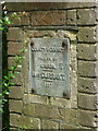
Branksome: Dorset side of the former boundary marker
The west facing side of the Image confirms that this was (until 1974) the Dorset side of the border (it refers to the side it faces, rather than being a 'welcome' sign for the traveller seeing this side of the pillar).
Miss Durrant, named on the plaques, was the late-19th-century owner of the Branksome estate which straddled the boundary.
Image: © Chris Downer
Taken: 19 May 2014
0.11 miles
7
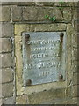
Branksome: Hampshire side of the former boundary marker
The east facing side of the Image confirms that this was (until 1974) the Hampshire side of the border (it refers to the side it faces, rather than being a 'welcome' sign for the traveller seeing this side of the pillar).
Miss Durrant, named on the plaques, was the late-19th-century owner of the Branksome estate which straddled the boundary.
Image: © Chris Downer
Taken: 19 May 2014
0.11 miles
8
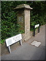
Branksome: former county boundary stone on Surrey Road
This pillar marks the former boundary between the counties of Dorset and Hampshire. It remains the borough boundary between Poole (this side) and Bournemouth, as can be seen by the modern street signage and the change in the pavement surface (where each council has maintained the road up to the border).
The plaque on this side (see Image for a close-up) and the opposing one refer to the side they face, rather than being a 'welcome' sign for the traveller who reads it: this one therefore refers to the county of Dorset and the parish of Kinson, while the opposite one (Image) refers to the county of Hampshire and the parish of Holdenhurst.
The boundary nearby (though not at this point) was altered in about 1904, shifting Kinson into Bournemouth and therefore into Hampshire. However, in 1974 the Hampshire/Dorset boundary was redrawn, bringing Bournemouth into Dorset. This is therefore no longer a county boundary but remains the borough boundary as discussed above.
Image: © Chris Downer
Taken: 19 May 2014
0.11 miles
9
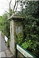
Old Boundary Marker by Surrey Road, Poole parish
County Boundary Marker by the UC road, in parish of Poole (Poole District), Surrey Road, next to entrance drive to No 55.
Surveyed
Milestone Society National ID: DO_DOHA01cb
Image: © Milestone Society
Taken: Unknown
0.11 miles
10
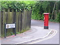
Branksome: postbox № BH12 241, Nelson Road
An Edward VII-reign postbox on the corner of Ipswich Road, just after the point (when travelling towards us) that Nelson Road has crossed Image It is emptied finally at 5:30pm on weekdays and at 11:30am on Saturdays.
Image: © Chris Downer
Taken: 28 Jun 2009
0.11 miles