Branksome: Dorset side of the former boundary marker
Introduction
The photograph on this page of Branksome: Dorset side of the former boundary marker by Chris Downer as part of the Geograph project.
The Geograph project started in 2005 with the aim of publishing, organising and preserving representative images for every square kilometre of Great Britain, Ireland and the Isle of Man.

There are currently over 7.5m images from over 14,400 individuals and you can help contribute to the project by visiting https://www.geograph.org.uk
Branksome: Dorset side of the former boundary marker
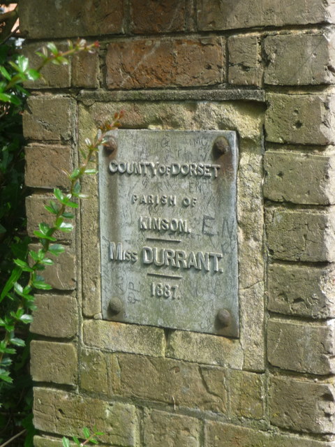
Image: © Chris Downer Taken: 19 May 2014
The west facing side of the Image confirms that this was (until 1974) the Dorset side of the border (it refers to the side it faces, rather than being a 'welcome' sign for the traveller seeing this side of the pillar). Miss Durrant, named on the plaques, was the late-19th-century owner of the Branksome estate which straddled the boundary.
Images are licensed for reuse under creativecommons.org/licenses/by-sa/2.0
Image Location
Latitude
50.727581
Longitude
-1.904597