
IMAGES TAKEN NEAR TO
Roosevelt Crescent, BOURNEMOUTH, BH11 9BS
Introduction
This page details the photographs taken nearby to Roosevelt Crescent, BH11 9BS by members of the Geograph project.
The Geograph project started in 2005 with the aim of publishing, organising and preserving representative images for every square kilometre of Great Britain, Ireland and the Isle of Man.

There are currently over 7.5m images from over14,400 individuals and you can help contribute to the project by visiting https://www.geograph.org.uk
Image Map
Images are licensed for reuse under creativecommons.org/licenses/by-sa/2.0
Notes
- Clicking on the map will re-center to the selected point.
- The higher the marker number, the further away the image location is from the centre of the postcode.
Image Listing (111 Images Found)
Images are licensed for reuse under creativecommons.org/licenses/by-sa/2.0
Image
Details
Distance
1
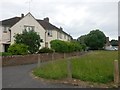
Kinson: footpath E25, Roosevelt Crescent
Roosevelt Crescent is a rather elongated crescent shape, turning back on itself quite sharply and with one end just along Truman Road from the other. The houses on the inside of the 180° turn do not follow the route of the road, but leave a semi-circular grass space between them and it (see Image).
The path along their frontages is designated as public footpath E25 and it is a modest 42m in length, but by no means short in comparison to some other public footpaths in the borough. See Image for the view from the other end, rather cluttered with parked cars.
Image: © Chris Downer
Taken: 14 Jun 2016
0.01 miles
2
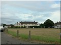
Kinson: the inside bend of Roosevelt Crescent
Roosevelt Crescent is a small development of council housing forming, as its name suggests, a crescent shape - albeit an elongated one. The inside bend is thus quite sharp and it contains a small green space, while the houses around the curve are set back.
The short-cut path along the frontage of the houses is a public right of way, footpath E25, and can be seen here Image
Image: © Chris Downer
Taken: 29 Jul 2016
0.01 miles
3
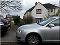
Kinson: southern end of footpath E25
Roosevelt Crescent is a rather elongated crescent shape, turning back on itself quite sharply and with one end just along Truman Road from the other. The houses on the inside of the 180° turn do not follow the route of the road, but leave a semi-circular grass space between them and it (see Image).
The path along their frontages is designated as public footpath E25 and it is a modest 42m in length, but by no means short in comparison to some other public footpaths in the borough.
See Image for the view along the path from the other end, a view less obscured by parked cars.
Image: © Chris Downer
Taken: 18 Mar 2017
0.01 miles
4
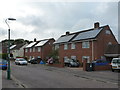
Bournemouth: council houses in Roosevelt Crescent
Bournemouth Borough Council has recently started a programme of installing photovoltaic cells on the roofs of its housing stock. I presume those houses without them are probably no longer in council ownership.
Image: © Chris Downer
Taken: 9 Jul 2012
0.02 miles
5
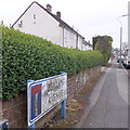
Kinson: Berrans Avenue
The end wall and frontages of the council houses in the background illustrate the nature of this road. It is quite long for a dead-end without any turnings.
The sign is of a design that became prevalent in Bournemouth around 1990 and was in use for most of that decade. Many are starting to look a bit shabby now, but although this one is grubby its white surface isn't flaking and the blue border is intact.
This is photo no.36 of a series of 451 in my coronavirus lockdown walking project:
See https://www.geograph.org.uk/article/My-2020-Coronavirus-Lockdown-walking-project for the complete set of photos.
Image: © Chris Downer
Taken: 18 Apr 2020
0.05 miles
6
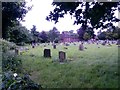
Kinson: the end of footpath E26
This public footpath runs along the western edge of the churchyard and comes to an abrupt end in this corner - the ultimate 'dead end' for a footpath, I suppose. The 1:25,000 map suggests that it possibly linked up with a path (not designated as a public right of way) behind us to Berrans Avenue - but there is no evidence of it on the ground. Instead, behind us is just a concrete wall at the backs of gardens - and not a new-looking one either.
See Image] for the path a short distance ahead of us, and further links to follow the path back to the church gate.
Image: © Chris Downer
Taken: 29 Jun 2016
0.07 miles
7
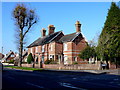
House on Wimborne Rd
This red brick Victorian detached house with a small modern extension sits at the junction with Truman Rd. The road in the foreground is the A341 Wimborne Rd.
Image: © Nigel Mykura
Taken: 15 Nov 2011
0.07 miles
8
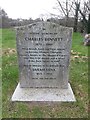
Kinson: gravestone of Britain?s first Olympic athletics champion
Charles Bennett, Britain's first Olympic athletics gold medallist, is buried in Kinson churchyard (Image). He won the 1500m in 1900 in a time of 4:06.
The gravestone is a replacement one from 2011.
He died in 1949 according to the Wikipedia list of Charles Bennetts, and in 1950 according to his actual Wikipedia page - but I guess we'd better assume the gravestone is correct, with 1948!
Image: © Chris Downer
Taken: 19 Mar 2017
0.07 miles
9
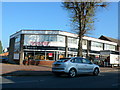
Furniture Store
This shop is on the north side of the Wimborne Rd the A341 at Kinson. It is on the junction with Truman Rd.
Image: © Nigel Mykura
Taken: 15 Nov 2011
0.08 miles
10
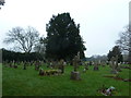
Holy Epiphany, Muscliff: churchyard (b)
Image: © Basher Eyre
Taken: 9 Feb 2013
0.08 miles