
IMAGES TAKEN NEAR TO
Pilot Hight Road, BOURNEMOUTH, BH11 8EX
Introduction
This page details the photographs taken nearby to Pilot Hight Road, BH11 8EX by members of the Geograph project.
The Geograph project started in 2005 with the aim of publishing, organising and preserving representative images for every square kilometre of Great Britain, Ireland and the Isle of Man.

There are currently over 7.5m images from over14,400 individuals and you can help contribute to the project by visiting https://www.geograph.org.uk
Image Map
Images are licensed for reuse under creativecommons.org/licenses/by-sa/2.0
Notes
- Clicking on the map will re-center to the selected point.
- The higher the marker number, the further away the image location is from the centre of the postcode.
Image Listing (77 Images Found)
Images are licensed for reuse under creativecommons.org/licenses/by-sa/2.0
Image
Details
Distance
1
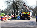
Bournemouth : Moore Avenue Fibrocity
These workmen are working on behalf of Fibrocity Holdings Ltd, and installing fibre optics.
Image: © Lewis Clarke
Taken: 8 Mar 2010
0.03 miles
2
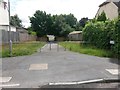
West Howe: footpath U26 from Pilot Hight Road
Looking along this broad public footpath that leads down to Moore Avenue (see Image).
Many of the footpaths on the West Howe estate and thereabouts have been given names in the last couple of years, a safety initiative whose intention is that, in the event of calling for help, one's location can be more easily described. This one has been named Spitfire Walk, no doubt a nod to the fact that the estate's roads are all surnames of servicemen from the Second World War with a local connection.
The only road to have a word before the surname is Pilot Hight Road, from which we are looking. Pilot Officer Cecil Hight was a New Zealander who flew Spitfires in the RAF. Coming under fire in August 1940, his aircraft was hit in a major air raid over Bournemouth. It is thought that he diverted his plane to avoid the town centre and it crashed in the Meyrick Park area - he died as a result of parachute failure.
See also Image
Image: © Chris Downer
Taken: 30 Jun 2016
0.04 miles
3
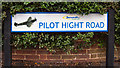
Pilot Officer C H Hight - a tribute: Pilot Hight Road, Bournemouth (3)
One of two road signs with Spitfire images at each end of Pilot Hight Road, Bournemouth. The road was named in memory of RAF Pilot Officer Cecil Henry Hight from New Zealand, aged 22, who died 15 August 1940 in the Battle of Britain, and the only Allied airman to have been killed over Bournemouth town during the Battle. These new road signs with Spitfire images replaced the ordinary ones at Pilot Hight Road in 2010.
Image
Image: © Mike Searle
Taken: 23 Sep 2015
0.04 miles
4
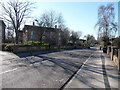
Bournemouth : Springwater Road
A residential road leading to Maclean Road.
Image: © Lewis Clarke
Taken: 8 Mar 2010
0.05 miles
5
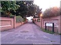
West Howe: footpath U26 to Pilot Hight Road
Many of the footpaths on the West Howe estate and thereabouts have been given names in the last couple of years, a safety initiative whose intention is that, in the event of calling for help, one's location can be more easily described. This one has been named Spitfire Walk, no doubt a nod to the fact that the estate's roads are all surnames of servicemen from the Second World War with a local connection.
The only road to have a word before the surname is Pilot Hight Road, to which this path leads. Pilot Officer Cecil Hight was a New Zealander who flew Spitfires in the RAF. Coming under fire in August 1940, his aircraft was hit in a major air raid over Bournemouth. It is thought that he diverted his plane to avoid the town centre and it crashed in the Meyrick Park area - he died as a result of parachute failure.
See Image for a view down the path from the other end.
See also Image
Image: © Chris Downer
Taken: 27 Jun 2016
0.05 miles
6
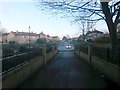
West Howe: footpath U26 comes out on Moore Avenue
Many of the footpaths on the West Howe estate and thereabouts have been given names in the last couple of years, a safety initiative whose intention is that, in the event of calling for help, one's location can be more easily described. This one has been named Spitfire Walk, no doubt a nod to the fact that the estate's roads are all surnames of servicemen from the Second World War with a local connection. (See also Image)
This footpath leads down from Pilot Hight Road and comes out on Moore Avenue just ahead. Opposite is the turning for Cunningham Place, leading to Cunningham Crescent which is the centre of the estate, with shops, library etc.
See Image for the view up the path from the pavement ahead, and Image for the view from the top end behind us.
Image: © Chris Downer
Taken: 6 Mar 2017
0.05 miles
7
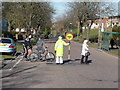
Bournemouth : Moore Avenue & Lollipop Lady
A lollipop lady guides these people across the road and stops any oncoming traffic - but the road seemed very quiet.
Image: © Lewis Clarke
Taken: 8 Mar 2010
0.05 miles
8
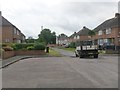
West Howe: footpath U27 from Mandale Close
Mandale Close and Springwater Close are two parallel roads which meet end-to-end via this public footpath. Although the vehicular carriageways do not meet, the houses continue without interruption, as if it were a single road.
See Image for a view from down by the railings.
Image: © Chris Downer
Taken: 30 Jun 2016
0.06 miles
9
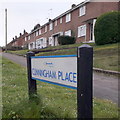
West Howe: Cunningham Place
A short link road from Moore Avenue to Cunningham Crescent in the very heart of the West Howe council estate. Behind the sign, we see terraced council houses – West Howe has the whole gamut of housing, from these to semi-detached houses and bungalows to blocks of flats.
The sign dates from 2010-15 when this more modern, abstract emblem rather than the traditional town coat of arms as the working logo of the council.
This is photo no.99 of a series of 453 in my coronavirus lockdown walking project:
See https://www.geograph.org.uk/article/My-2020-Coronavirus-Lockdown-walking-project for the complete set of photos.
Image: © Chris Downer
Taken: 18 Apr 2020
0.06 miles
10
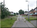
West Howe: footpath U27 enters Springwater Close
Mandale Close and Springwater Close are two parallel roads which meet end-to-end via this public footpath. Although the vehicular carriageways do not meet, the houses continue without interruption, as if it were a single road.
See Image] for a view along the whole path from Mandale Close, behind us.
Image: © Chris Downer
Taken: 30 Jun 2016
0.06 miles