West Howe: footpath U26 from Pilot Hight Road
Introduction
The photograph on this page of West Howe: footpath U26 from Pilot Hight Road by Chris Downer as part of the Geograph project.
The Geograph project started in 2005 with the aim of publishing, organising and preserving representative images for every square kilometre of Great Britain, Ireland and the Isle of Man.

There are currently over 7.5m images from over 14,400 individuals and you can help contribute to the project by visiting https://www.geograph.org.uk
West Howe: footpath U26 from Pilot Hight Road
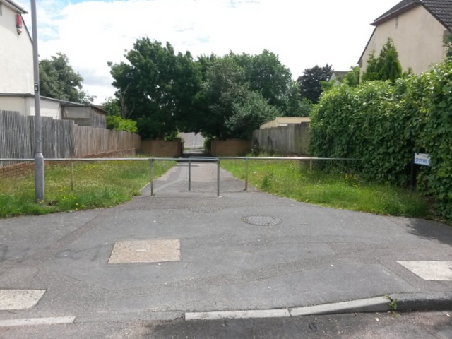
Image: © Chris Downer Taken: 30 Jun 2016
Looking along this broad public footpath that leads down to Moore Avenue (see Image). Many of the footpaths on the West Howe estate and thereabouts have been given names in the last couple of years, a safety initiative whose intention is that, in the event of calling for help, one's location can be more easily described. This one has been named Spitfire Walk, no doubt a nod to the fact that the estate's roads are all surnames of servicemen from the Second World War with a local connection. The only road to have a word before the surname is Pilot Hight Road, from which we are looking. Pilot Officer Cecil Hight was a New Zealander who flew Spitfires in the RAF. Coming under fire in August 1940, his aircraft was hit in a major air raid over Bournemouth. It is thought that he diverted his plane to avoid the town centre and it crashed in the Meyrick Park area - he died as a result of parachute failure. See also Image
Images are licensed for reuse under creativecommons.org/licenses/by-sa/2.0
Image Location
Latitude
50.758972
Longitude
-1.912757