
IMAGES TAKEN NEAR TO
Maclean Road, BOURNEMOUTH, BH11 8EP
Introduction
This page details the photographs taken nearby to Maclean Road, BH11 8EP by members of the Geograph project.
The Geograph project started in 2005 with the aim of publishing, organising and preserving representative images for every square kilometre of Great Britain, Ireland and the Isle of Man.

There are currently over 7.5m images from over14,400 individuals and you can help contribute to the project by visiting https://www.geograph.org.uk
Image Map
Images are licensed for reuse under creativecommons.org/licenses/by-sa/2.0
Notes
- Clicking on the map will re-center to the selected point.
- The higher the marker number, the further away the image location is from the centre of the postcode.
Image Listing (66 Images Found)
Images are licensed for reuse under creativecommons.org/licenses/by-sa/2.0
Image
Details
Distance
1
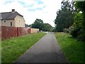
West Howe: Heathlands Walk approaches Maclean Road
Looking along the southeast end of public footpath U08 as it heads for Maclean Road, with Springwater Road facing us in the background.
See Image for the view behind us, and Image for the view towards us from the road ahead.
Many of the footpaths on the West Howe estate and thereabouts have been given names in the last couple of years, a safety initiative whose intention is that, in the event of calling for help, one's location can be more easily described. This one has been named Heathlands Walk, after the primary school serving the estate, just a minute's walk beyond the end of the path (see Image).
Image: © Chris Downer
Taken: 30 Jun 2016
0.02 miles
2
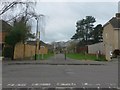
West Howe: footpath U08 from Maclean Road
Looking across the junction of Maclean Road (left-right) and Springwater Road (behind us), along a grass-flanked public footpath to Mandale Road.
Many of the footpaths on the West Howe estate and thereabouts have been given names in the last couple of years, a safety initiative whose intention is that, in the event of calling for help, one's location can be more easily described. This one has been named Heathlands Walk, after the primary school serving the estate, just a minute's walk behind us (see Image).
See Image for the next view along the path.
Image: © Chris Downer
Taken: 18 Mar 2017
0.02 miles
3
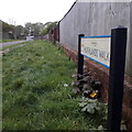
West Howe: Heathlands Walk
One of those grass-lined paths which are quite common in council estates of the era, this one is towards the west of the large 1950s West Howe estate. It links Maclean Road (where we are standing) and Mandale Road (ahead).
It is a public footpath, and is discussed in more detail in this wider view from behind us: Image – including the fairly recent naming of such paths.
The sign is a modern one, from 2010-15 when this more modern, abstract emblem rather than the traditional town coat of arms as the working logo of the council.
This is photo no.190 of a series of 453 in my coronavirus lockdown walking project:
See https://www.geograph.org.uk/article/My-2020-Coronavirus-Lockdown-walking-project for the complete set of photos.
Image: © Chris Downer
Taken: 18 Apr 2020
0.02 miles
4
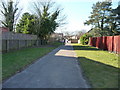
Bournemouth : Kinson Footpath
This footpath goes between houses along Maclean Road and Mandale Road.
Image: © Lewis Clarke
Taken: 8 Mar 2010
0.02 miles
5
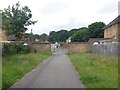
West Howe: heading for Mandale Road on footpath U08
Looking along this public footpath, with broad green verges, between Maclean and Mandale Road as it goes towards the latter. See Image for the view towards us and Image for the view behind.
Many of the footpaths on the West Howe estate and thereabouts have been given names in the last couple of years, a safety initiative whose intention is that, in the event of calling for help, one's location can be more easily described. This one has been named Heathlands Walk, after the primary school serving the estate, just a minute's walk beyond the end of the path (see Image).
Image: © Chris Downer
Taken: 30 Jun 2016
0.03 miles
6
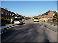
Bournemouth : Maclean Road
A quiet road in Bournemouth with a woman pushing a pushchair wondering why I'm taking a photograph.
Image: © Lewis Clarke
Taken: 8 Mar 2010
0.03 miles
7
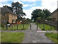
West Howe: footpath U08 from Mandale Road
This public footpath is lined by a wide grassed area and leads through to Maclean Road.
Many of the footpaths on the West Howe estate and thereabouts have been given names in the last couple of years, a safety initiative whose intention is that, in the event of calling for help, one's location can be more easily described. This one has been named Heathlands Walk, after the primary school serving the estate, just a minute's walk beyond the end of the path (see Image).
See Image for a view towards us from beyond the wall.
Image: © Chris Downer
Taken: 30 Jun 2016
0.03 miles
8
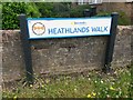
West Howe: sign on Heathlands Walk
This public footpath is lined by a wide grassed area and leads through to Maclean Road.
Many of the footpaths on the West Howe estate and thereabouts have been given names in the last couple of years, a safety initiative whose intention is that, in the event of calling for help, one's location can be more easily described. This one has been named Heathlands Walk, after the primary school serving the estate, just a minute's walk beyond the end of the path. The sign incorporates the logo of the school.
See Image for a view along the path, with this sign on the left.
Image: © Chris Downer
Taken: 30 Jun 2016
0.04 miles
9
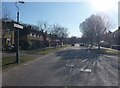
Bournemouth : Mandale Road
This road taken opposite the junction with Gladdis Road leads to Turbary Park Avenue.
Image: © Lewis Clarke
Taken: 8 Mar 2010
0.05 miles
10
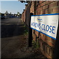
West Howe: Andrews Close
Andrews Close is a cul-de-sac off Springwater Road in the heart of the large West Howe council estate. It leads to Heathlands Primary School (now Heathlands Primary Academy) which can be seen facing us at the dead end.
The sign is a modern one, from around 2010 when the borough introduced this more modern, abstract emblem rather than the traditional town coat of arms.
This is photo no.10 of a series of 451 in my coronavirus lockdown walking project
See https://www.geograph.org.uk/article/My-2020-Coronavirus-Lockdown-walking-project for the complete set of photos.
Image: © Chris Downer
Taken: 11 Apr 2020
0.06 miles