
IMAGES TAKEN NEAR TO
Millhams Road, BOURNEMOUTH, BH10 7LL
Introduction
This page details the photographs taken nearby to Millhams Road, BH10 7LL by members of the Geograph project.
The Geograph project started in 2005 with the aim of publishing, organising and preserving representative images for every square kilometre of Great Britain, Ireland and the Isle of Man.

There are currently over 7.5m images from over14,400 individuals and you can help contribute to the project by visiting https://www.geograph.org.uk
Image Map
Images are licensed for reuse under creativecommons.org/licenses/by-sa/2.0
Notes
- Clicking on the map will re-center to the selected point.
- The higher the marker number, the further away the image location is from the centre of the postcode.
Image Listing (115 Images Found)
Images are licensed for reuse under creativecommons.org/licenses/by-sa/2.0
Image
Details
Distance
1
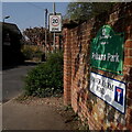
Kinson: Manor Farm Road
The northernmost part of the Borough of Bournemouth, Manor Farm is at the far end of this sensibly named road. It also leads to the Pelhams leisure centre.
The sign is a nonstandard one, similar to several of the standard-issue council signs over the last 20 years or so, but lacking the council logo or name along the top.
This is photo no.259 of a series of 453 in my coronavirus lockdown walking project:
See https://www.geograph.org.uk/article/My-2020-Coronavirus-Lockdown-walking-project for the complete set of photos.
Image: © Chris Downer
Taken: 10 Apr 2020
0.03 miles
2
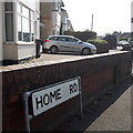
Kinson: Home Road
Home Road is a short road in central Kinson, used by buses purely as an easy way of turning round as the Bournemouth-Kinson routes terminate just around the corner from here. As can be glimpsed here, it has detached houses on one side and mainly detached bungalows on the other.
The sign is the standard Bournemouth nameplate from the 1980s, affixed with tubular steel which protrudes at each side. There are much longer names than this that are written in full, but the abbreviation Rd appears here despite the short name!
This is photo no.203 of a series of 453 in my coronavirus lockdown walking project:
See https://www.geograph.org.uk/article/My-2020-Coronavirus-Lockdown-walking-project for the complete set of photos.
Image: © Chris Downer
Taken: 10 Apr 2020
0.05 miles
3

Kinson: Millhams Close
A cul-de-sac of bungalows off what was once a reasonably major side road, Millhams Road.
The sign is the standard Bournemouth nameplate from the 1980s, affixed with tubular steel which protrudes at each side. The vacant post just to the left almost certainly once had a No Through Road sign affixed to it, such as at Image
This is photo no.272 of a series of 453 in my coronavirus lockdown walking project:
See https://www.geograph.org.uk/article/My-2020-Coronavirus-Lockdown-walking-project for the complete set of photos.
Image: © Chris Downer
Taken: 15 Apr 2020
0.06 miles
4
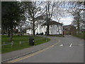
Kinson, Pelhams
Late C18 mansion, English Heritage-listed, on Millhams Lane; currently used as community centre, with separate entrance at left. For more information, see http://www.imagesofengland.org.uk/Details/Default.aspx?id=101789&mode=adv
Image: © Mike Faherty
Taken: 28 Feb 2009
0.07 miles
5

Kinson: Millhams Drive
A cul-de-sac off Millhams Road, younger than and diagonally opposite Image
The sign is of a design that became prevalent in Bournemouth around 1990 and was in use for most of that decade. Many are starting to look a bit shabby now, with peeling white or fading blue, and this is a very good example of the white deterioration.
This is photo no.273 of a series of 453 in my coronavirus lockdown walking project:
See https://www.geograph.org.uk/article/My-2020-Coronavirus-Lockdown-walking-project for the complete set of photos.
Image: © Chris Downer
Taken: 15 Apr 2020
0.08 miles
6
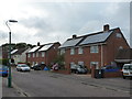
Bournemouth: council houses in Roosevelt Crescent
Bournemouth Borough Council has recently started a programme of installing photovoltaic cells on the roofs of its housing stock. I presume those houses without them are probably no longer in council ownership.
Image: © Chris Downer
Taken: 9 Jul 2012
0.08 miles
7
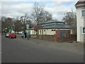
Kinson, Pelhams Clinic
No useful information about this clinic on the NHS web site; perhaps unfair, as it seems to be having a rebuild. http://www.nhs.uk/ServiceDirectories/Pages/Hospital.aspx?id=5QN02
Image: © Mike Faherty
Taken: 28 Feb 2009
0.09 miles
8
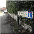
Kinson: Lake Road
A short road on the eastern side of Kinson village green, this being the Millhams Road end, while it comes out on the main Wimborne Road next to the library, but is chopped into two halves near that end (hence the no-through road sign).
It is one of the original roads in the centre of Kinson, it contains Victorian houses which are still named and not numbered.
The road sign is a standard one from around 2000-2006, perhaps a little earlier, featuring the borough coat of arms.
This is photo no.234 of a series of 453 in my coronavirus lockdown walking project:
See https://www.geograph.org.uk/article/My-2020-Coronavirus-Lockdown-walking-project for the complete set of photos.
Image: © Chris Downer
Taken: 10 Apr 2020
0.09 miles
9
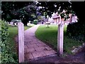
Kinson: the start of footpath E26
This public footpath is unusual in that it is the main path through the churchyard. It is also unusual in that it doesn't lead anywhere as a through route - see Image to link through to more pictures along the route.
Image: © Chris Downer
Taken: 29 Jun 2016
0.09 miles
10
Holy Epiphany, Muscliff: churchyard (b)
Image: © Basher Eyre
Taken: 9 Feb 2013
0.10 miles