
IMAGES TAKEN NEAR TO
Leybourne Avenue, BOURNEMOUTH, BH10 6HD
Introduction
This page details the photographs taken nearby to Leybourne Avenue, BH10 6HD by members of the Geograph project.
The Geograph project started in 2005 with the aim of publishing, organising and preserving representative images for every square kilometre of Great Britain, Ireland and the Isle of Man.

There are currently over 7.5m images from over14,400 individuals and you can help contribute to the project by visiting https://www.geograph.org.uk
Image Map
Images are licensed for reuse under creativecommons.org/licenses/by-sa/2.0
Notes
- Clicking on the map will re-center to the selected point.
- The higher the marker number, the further away the image location is from the centre of the postcode.
Image Listing (68 Images Found)
Images are licensed for reuse under creativecommons.org/licenses/by-sa/2.0
Image
Details
Distance
1
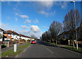
Leybourne Avenue
Leybourne Avenue, at the junction with Brockley Road.
Image: © Peter Kazmierczak
Taken: 7 Mar 2016
0.04 miles
2
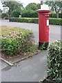
Northbourne: postbox № BH10 315, Saxonhurst Road
This postbox, being in Saxonhurst Road which has road and pavement separated by small hedges, has its own little access path.
Image: © Chris Downer
Taken: 6 Jul 2008
0.08 miles
3
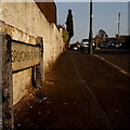
Northbourne: Broadhurst Avenue
A short road within a large area of similar housing - detached bungalows - with the added feature of Image just along to the left.
The sign is a modern one, probably from around 2000, and is not rare in this neck of the woods. It morphed into a later design, including BOURNEMOUTH BOROUGH COUNCIL in smaller letters at the top, and the borough coat of arms on the left.
This is photo no.51 of a series of 453 in my coronavirus lockdown walking project:
See https://www.geograph.org.uk/article/My-2020-Coronavirus-Lockdown-walking-project for the complete set of photos.
Image: © Chris Downer
Taken: 11 Apr 2020
0.09 miles
4
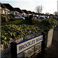
Northbourne: Brockley Road
Looking along a line of bungalows on the east side of Brockley Road, that typify this whole Northbourne area.
The sign is a very recent one, erected since 2017/18 when the council started using plain nameplates, without BOURNEMOUTH BOROUGH COUNCIL in smaller type across the top.
This is photo no.52 of a series of 453 in my coronavirus lockdown walking project:
See https://www.geograph.org.uk/article/My-2020-Coronavirus-Lockdown-walking-project for the complete set of photos.
Image: © Chris Downer
Taken: 11 Apr 2020
0.10 miles
5

Northbourne: Western Avenue
A typical Northbourne street of bungalows, viewed the morning after substantial overnight snowfall - Bournemouth's heaviest for 17 years.
Image: © Chris Downer
Taken: 2 Dec 2010
0.10 miles
6
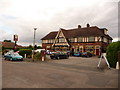
Northbourne: the Crown
A conspicuously large building in the bungalowy back streets of Northbourne, and yet the Crown is not easy to find! The Eldridge Pope pub was originally the Crown & Sceptre but followed the trend of shortening its name about ten years ago, now run by Marston's.
Image: © Chris Downer
Taken: 29 Aug 2010
0.12 miles
7
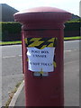
Northbourne: this postbox is unsafe
I was annoyed as, currently on crutches, I thought it would be easier to get off the bus here than to have struggled across the road down in Kinson - so you can imagine my frustration when I got off the bus and saw this notice.
There is no indication of what injury the box is suffering, but it is clearly more than simply broken (do not use) but rather, dangerous (do not touch). In healthier times it looked like this: Image
Image: © Chris Downer
Taken: 15 May 2014
0.12 miles
8
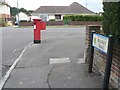
Northbourne: postbox № BH10 340, Palfrey Road
A George VI-reign box – fairly rarely for Bournemouth at least – in Palfrey Road, right by its junction with Leybourne Avenue.
Image: © Chris Downer
Taken: 6 Jul 2008
0.12 miles
9
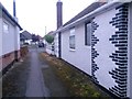
Northbourne: footpath E41 emerges onto Western Avenue
This public footpath, from the dead end of Hill View Road, reaches Western Avenue between even numbers 149 and 151. Number 149 has particularly distinctive brickwork on the chimney breasts.
See Image] for the view towards us from across the road, and Image] for the next view along the path behind, with links to further photos on the route.
Image: © Chris Downer
Taken: 10 Jun 2016
0.13 miles
10
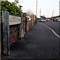
Northbourne: Alderley Road
Looking along this short suburban road in an area of middle-class bungalows.
The sign is a modern one, probably from around 2000, and is not rare in this neck of the woods. It morphed into another design, including BOURNEMOUTH BOROUGH COUNCIL in smaller letters at the top, and the borough coat of arms on the left.
This is photo no.6 of a series of 451 in my coronavirus lockdown walking project:
See https://www.geograph.org.uk/article/My-2020-Coronavirus-Lockdown-walking-project for the complete set of photos.
Image: © Chris Downer
Taken: 11 Apr 2020
0.13 miles