
IMAGES TAKEN NEAR TO
Dudley Road, BOURNEMOUTH, BH10 6BS
Introduction
This page details the photographs taken nearby to Dudley Road, BH10 6BS by members of the Geograph project.
The Geograph project started in 2005 with the aim of publishing, organising and preserving representative images for every square kilometre of Great Britain, Ireland and the Isle of Man.

There are currently over 7.5m images from over14,400 individuals and you can help contribute to the project by visiting https://www.geograph.org.uk
Image Map
Images are licensed for reuse under creativecommons.org/licenses/by-sa/2.0
Notes
- Clicking on the map will re-center to the selected point.
- The higher the marker number, the further away the image location is from the centre of the postcode.
Image Listing (192 Images Found)
Images are licensed for reuse under creativecommons.org/licenses/by-sa/2.0
Image
Details
Distance
1
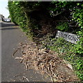
Northbourne: Dudley Gardens
Dudley Gardens was built off Dudley Road in perhaps the late 1970s or early 80s, and contains some small retirement-type semi-detached bungalows which can barely be seen from here, because they face the path beyond the carriageway. A public right of way remains, presumably from before the development was built and the path would have gone through perhaps a small wooded patch.
We can see the bungalows themselves here: Image - along with links to further photos along the public footpath.
The sign is the standard Bournemouth nameplate from the 1980s, affixed with tubular steel which protrudes at each side.
This is photo no.117 of a series of 453 in my coronavirus lockdown walking project:
See https://www.geograph.org.uk/article/My-2020-Coronavirus-Lockdown-walking-project for the complete set of photos.
Image: © Chris Downer
Taken: 12 Apr 2020
0.03 miles
2
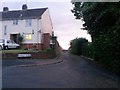
Northbourne: Dudley Gardens from Dudley Road
The turning to this short cul-de-sac, which is unusual because the carriageway finishes before its properties begin - see Image
The route also forms part of public footpath E44, which continues into Leybourne Avenue.
Image: © Chris Downer
Taken: 22 Jun 2016
0.04 miles
3
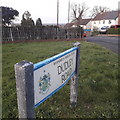
Northbourne: Dudley Road
Looking down Dudley Road from Leybourne Avenue. This junction has a quarter-circle of grass on each corner, edged by the low walls of the semi-detached bungalows on the corners. Each semi has the first number in Dudley attached to a mid-100s number in Leybourne Avenue.
The road sign is a standard one from around 2000-2006, perhaps a little earlier, featuring the borough coat of arms.
This is photo no.118 of a series of 453 in my coronavirus lockdown walking project:
See https://www.geograph.org.uk/article/My-2020-Coronavirus-Lockdown-walking-project for the complete set of photos.
Image: © Chris Downer
Taken: 10 Apr 2020
0.04 miles
4
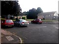
Northbourne: Dudley Gardens ends and its houses begin
Looking across the dead end of Dudley Gardens, which is unusual in that its houses (well, bungalows actually) commence after the driveable carriageway stops. The four pairs of semi-detached bungalows - one seen on the left, and the first of a row of three on the right, have a path running between them which also forms public footpath E44 from Dudley Road to Leybourne Avenue.
See Image for a view towards us from among the bungalows, and Image] for a view up the road from its junction behind us.
Image: © Chris Downer
Taken: 6 Jul 2016
0.05 miles
5
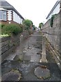
Northbourne: footpath O01 from Northbourne Avenue
This public footpath is a little cut-through between the houses of Northbourne Avenue and (in the distance) Palfrey Road.
See Image for the view towards us from just ahead, with links to further photos along the path.
Image: © Chris Downer
Taken: 10 Jun 2016
0.05 miles
6
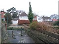
Northbourne: footpath O01 reaches Northbourne Avenue
A public footpath from Palfrey Road, the next parallel street, comes out on Northbourne Avenue with the expected railings and some old concrete posts.
See Image for the view up the path from the pavement ahead, and Image for the next photo on the path behind us.
Image: © Chris Downer
Taken: 7 Jan 2017
0.05 miles
7
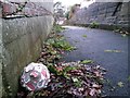
Northbourne: old football discarded on footpath O01
Looking along this public footpath linking Palfrey Road (behind) and Northbourne Avenue. It looks like it's been a while since this football last saw the end of anyone's boot.
See Image for the next photo on the path ahead, and Image for the view behind us.
Image: © Chris Downer
Taken: 7 Jan 2017
0.05 miles
8
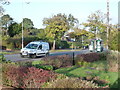
Northbourne: Leybourne Avenue goes downhill
This is one of the main thoroughfares from the Winton to Kinson and as such is very well used. Here, we see it head downhill having been more or less on the level for the last half-mile or more.
Taken on the morning of 16 October 2012, the 25th anniversary of the Great Storm of 1987. One of my most vivid memories, as a twelve-year-old witnessing the aftermath, was the sight of the bus shelter roof in the garden immediately in front of where we are standing now. The bus shelter can be seen, partly obscured by a tree in front of the approaching coach.
Our position is a small grass quarter-circle on the corner of Dudley Road, although the pavement does not cut across the corner.
Image: © Chris Downer
Taken: 16 Oct 2012
0.05 miles
9
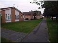
Northbourne: Dudley Gardens bungalows
A funny little thoroughfare off Dudley Road, the driveable carriageway (Image) is just a stunted cul-de-sac while the properties face a public footpath, E44, linking Leybourne Avenue (just behind us: Image).
There are three pairs of semi-detached bungalows on the left (odd numbers) and just one, in the distance, on the right (2 and 4).
Image: © Chris Downer
Taken: 22 Jun 2014
0.06 miles
10
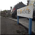
Northbourne: Hogue Avenue
Part of a small layout of roads resembling a fork, Hogue Avenue being the horizontal that holds the three tines of the fork: Ferncroft Road, Ashridge Avenue and Pinewood Avenue. Dudley Road finishes the cutlery analogy by providing the handle, slightly offset from centre.
This sign faces down Ashridge Avenue and is of a design that became prevalent in Bournemouth around 1990 and was in use for most of that decade. Many are starting to look a bit shabby now, and this one is a prime example of both afflictions: the blue border fading and the white surface unpeeling.
This is photo no.201 of a series of 453 in my coronavirus lockdown walking project:
See https://www.geograph.org.uk/article/My-2020-Coronavirus-Lockdown-walking-project for the complete set of photos.
Image: © Chris Downer
Taken: 13 Apr 2020
0.07 miles