Northbourne: Leybourne Avenue goes downhill
Introduction
The photograph on this page of Northbourne: Leybourne Avenue goes downhill by Chris Downer as part of the Geograph project.
The Geograph project started in 2005 with the aim of publishing, organising and preserving representative images for every square kilometre of Great Britain, Ireland and the Isle of Man.

There are currently over 7.5m images from over 14,400 individuals and you can help contribute to the project by visiting https://www.geograph.org.uk
Northbourne: Leybourne Avenue goes downhill
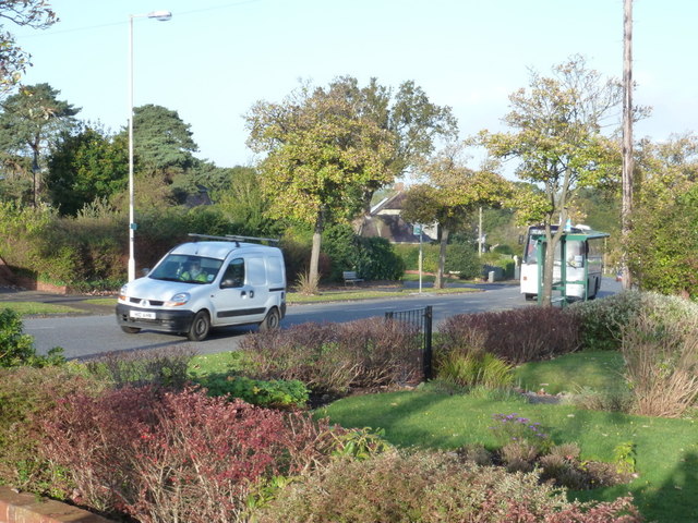
Image: © Chris Downer Taken: 16 Oct 2012
This is one of the main thoroughfares from the Winton to Kinson and as such is very well used. Here, we see it head downhill having been more or less on the level for the last half-mile or more. Taken on the morning of 16 October 2012, the 25th anniversary of the Great Storm of 1987. One of my most vivid memories, as a twelve-year-old witnessing the aftermath, was the sight of the bus shelter roof in the garden immediately in front of where we are standing now. The bus shelter can be seen, partly obscured by a tree in front of the approaching coach. Our position is a small grass quarter-circle on the corner of Dudley Road, although the pavement does not cut across the corner.
Images are licensed for reuse under creativecommons.org/licenses/by-sa/2.0
Image Location
Latitude
50.76435
Longitude
-1.89162