
IMAGES TAKEN NEAR TO
Draycott Road, BOURNEMOUTH, BH10 5AP
Introduction
This page details the photographs taken nearby to Draycott Road, BH10 5AP by members of the Geograph project.
The Geograph project started in 2005 with the aim of publishing, organising and preserving representative images for every square kilometre of Great Britain, Ireland and the Isle of Man.

There are currently over 7.5m images from over14,400 individuals and you can help contribute to the project by visiting https://www.geograph.org.uk
Image Map
Images are licensed for reuse under creativecommons.org/licenses/by-sa/2.0
Notes
- Clicking on the map will re-center to the selected point.
- The higher the marker number, the further away the image location is from the centre of the postcode.
Image Listing (107 Images Found)
Images are licensed for reuse under creativecommons.org/licenses/by-sa/2.0
Image
Details
Distance
1
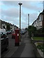
Ensbury Park: postbox № BH10 299, Draycott Road
Looking south along Draycott Road.
Image: © Chris Downer
Taken: 6 Jul 2008
0.01 miles
2
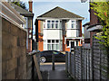
Alley from Beswick Avenue to Draycott Road
A public footpath.
Image: © Robin Webster
Taken: 25 Nov 2016
0.05 miles
3
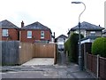
Ensbury Park: footpath U34 to Draycott Road
A short public footpath at the dead end of Beswick Avenue, leading between two houses to Draycott Road.
The number 14 on the gatepost on the left has DRAYCOTT ROAD below it - it is of course a rear driveway for the house which is not in Beswick Avenue.
See Image for the view along the path from the other end.
Image: © Chris Downer
Taken: 15 Jun 2016
0.05 miles
4

Ensbury Park: Catholic church of Our Lady of Victories and St. Bernadette
Image: © Chris Downer
Taken: 1 Jul 2007
0.06 miles
5

Ensbury Park: shrine at St. Bernadette?s church
This is in the grounds alongside Image
Image: © Chris Downer
Taken: 1 Jul 2007
0.06 miles
6
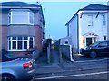
Ensbury Park: footpath U34 to Beswick Avenue
Dusk is virtually here on this drab February evening as we look along this small cut-through to the dead end of Beswick Avenue, which does a right-angled turn to almost meet us here on Draycott Road. See Image for the view along the path from the other end.
Image: © Chris Downer
Taken: 13 Feb 2017
0.06 miles
7
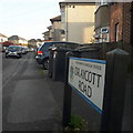
Ensbury Park: Draycott Road
Draycott Road can be a busy cut-through as it provides what can only really be described as a 'long cut' rather than a short cut, but it allows the most congested approach onto the Ensbury Park Gyratory to be avoided.
As the housing is mainly detached houses without driveways, and only some of them have converted their front yards to off-road parking, progress along here in morning rush hour can be frustratingly awkward - especially on Thursdays when the bins are emptied!
The road sign is a standard one from around 2000-2006, perhaps a little earlier, featuring the borough coat of arms.
This is photo no.115 of a series of 453 in my coronavirus lockdown walking project:
See https://www.geograph.org.uk/article/My-2020-Coronavirus-Lockdown-walking-project for the complete set of photos.
Image: © Chris Downer
Taken: 10 Apr 2020
0.07 miles
8
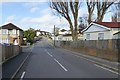
Barnes Road
Typical of the North Bournemouth suburbs. There appears to be an estate of portable buildings on the right.
Image: © David Lally
Taken: 10 Apr 2016
0.08 miles
9
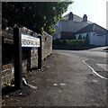
Ensbury Park: Hendford Road
We glimpse around the corner from Barnes Road into Hendford Road - as here, most of the roads hereabouts contain a mix of decent detached houses and bungalows. As is often the case, the pavement widens into a triangle on the corner, cutting a piece out of what would be the garden of the corner house.
The sign is a modern one, dating from around 2014-15, by which time the council had replaced the coloured logo, which had been prone to fading after a while, to simple wording BOURNEMOUTH BOROUGH COUNCIL in smaller type.
This is photo no.193 of a series of 453 in my coronavirus lockdown walking project:
See https://www.geograph.org.uk/article/My-2020-Coronavirus-Lockdown-walking-project for the complete set of photos.
Image: © Chris Downer
Taken: 13 Apr 2020
0.09 miles
10
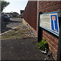
Ensbury Park: Hendford Gardens
A 1980s infill of bungalows, off Hendford Road - hence the name.
The road sign is a standard one from around 2000-2006, perhaps a little earlier, featuring the borough coat of arms. The no-through-road sign being incorporated into the nameplate is a common arrangement.
This is photo no.192 of a series of 453 in my coronavirus lockdown walking project:
See https://www.geograph.org.uk/article/My-2020-Coronavirus-Lockdown-walking-project for the complete set of photos.
Image: © Chris Downer
Taken: 13 Apr 2020
0.09 miles