
IMAGES TAKEN NEAR TO
Coombe Gardens, BOURNEMOUTH, BH10 5AG
Introduction
This page details the photographs taken nearby to Coombe Gardens, BH10 5AG by members of the Geograph project.
The Geograph project started in 2005 with the aim of publishing, organising and preserving representative images for every square kilometre of Great Britain, Ireland and the Isle of Man.

There are currently over 7.5m images from over14,400 individuals and you can help contribute to the project by visiting https://www.geograph.org.uk
Image Map
Images are licensed for reuse under creativecommons.org/licenses/by-sa/2.0
Notes
- Clicking on the map will re-center to the selected point.
- The higher the marker number, the further away the image location is from the centre of the postcode.
Image Listing (111 Images Found)
Images are licensed for reuse under creativecommons.org/licenses/by-sa/2.0
Image
Details
Distance
1
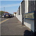
Ensbury Park: Coombe Gardens
A street of detached houses off Coombe Avenue - quite a long one considering that it's a dead end - with a double bend halfway along.
The road sign is a standard one from around 2000-2006, perhaps a little earlier, featuring the borough coat of arms. It is unusually long and low; the words are more usually written on two lines.
This is photo no.83 of a series of 453 in my coronavirus lockdown walking project:
See https://www.geograph.org.uk/article/My-2020-Coronavirus-Lockdown-walking-project for the complete set of photos.
Image: © Chris Downer
Taken: 12 Apr 2020
0.05 miles
2

Ensbury Park: shrine at St. Bernadette?s church
This is in the grounds alongside Image
Image: © Chris Downer
Taken: 1 Jul 2007
0.06 miles
3
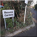
Ensbury Park: Beswick Gardens
A modern infill cul-de-sac built in the last five years or so, this photo of the road sign does not provide any meaningful view of the housing along the road. It comes off Beswick Avenue in its northernmost, dead-end section.
The sign, in the font Arial Bold, is not of any standard council design so I presume was put up by the developer rather than the local authority.
This is photo no.38 of a series of 451 in my coronavirus lockdown walking project:
See https://www.geograph.org.uk/article/My-2020-Coronavirus-Lockdown-walking-project for the complete set of photos.
Image: © Chris Downer
Taken: 10 Apr 2020
0.06 miles
4

Ensbury Park: Catholic church of Our Lady of Victories and St. Bernadette
Image: © Chris Downer
Taken: 1 Jul 2007
0.07 miles
5
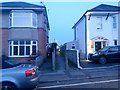
Ensbury Park: footpath U34 to Beswick Avenue
Dusk is virtually here on this drab February evening as we look along this small cut-through to the dead end of Beswick Avenue, which does a right-angled turn to almost meet us here on Draycott Road. See Image for the view along the path from the other end.
Image: © Chris Downer
Taken: 13 Feb 2017
0.07 miles
6
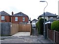
Ensbury Park: footpath U34 to Draycott Road
A short public footpath at the dead end of Beswick Avenue, leading between two houses to Draycott Road.
The number 14 on the gatepost on the left has DRAYCOTT ROAD below it - it is of course a rear driveway for the house which is not in Beswick Avenue.
See Image for the view along the path from the other end.
Image: © Chris Downer
Taken: 15 Jun 2016
0.08 miles
7
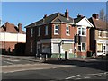
Ensbury Park: library
The smallest of Bournemouth's twelve libraries, by some margin!
Image: © Chris Downer
Taken: 30 Jan 2008
0.08 miles
8
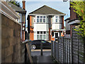
Alley from Beswick Avenue to Draycott Road
A public footpath.
Image: © Robin Webster
Taken: 25 Nov 2016
0.08 miles
9
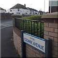
Ensbury Park: Coombe Avenue
Coombe Avenue forms, with Leybourne Avenue, a busy main route through Northbourne. Desirable detached housing is the order of the day hereabouts, although the block of flats on the corner, just to our right, is modern and replaced an old bungalow.
The sign is a modern one, from 2010-15 when this more modern, abstract emblem rather than the traditional town coat of arms as the working logo of the council.
This is photo no.82 of a series of 453 in my coronavirus lockdown walking project:
See https://www.geograph.org.uk/article/My-2020-Coronavirus-Lockdown-walking-project for the complete set of photos.
Image: © Chris Downer
Taken: 10 Apr 2020
0.09 miles
10
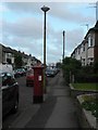
Ensbury Park: postbox № BH10 299, Draycott Road
Looking south along Draycott Road.
Image: © Chris Downer
Taken: 6 Jul 2008
0.09 miles