
IMAGES TAKEN NEAR TO
Kinson Road, BOURNEMOUTH, BH10 4AN
Introduction
This page details the photographs taken nearby to Kinson Road, BH10 4AN by members of the Geograph project.
The Geograph project started in 2005 with the aim of publishing, organising and preserving representative images for every square kilometre of Great Britain, Ireland and the Isle of Man.

There are currently over 7.5m images from over14,400 individuals and you can help contribute to the project by visiting https://www.geograph.org.uk
Image Map
Images are licensed for reuse under creativecommons.org/licenses/by-sa/2.0
Notes
- Clicking on the map will re-center to the selected point.
- The higher the marker number, the further away the image location is from the centre of the postcode.
Image Listing (84 Images Found)
Images are licensed for reuse under creativecommons.org/licenses/by-sa/2.0
Image
Details
Distance
1
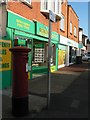
Wallisdown: postbox № BH10 261, Kinson Road
Standing on Kinson Road, alongside a row of shops which includes an Indian restaurant, estate agent and chemist.
Image: © Chris Downer
Taken: 3 Jul 2008
0.06 miles
2
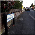
Wallisdown: Hood Crescent
Hood Crescent is an angular crescent off Kinson Road but with an additional arm, so shaped like an uppercase F (an upside-down F when seen on a map with north at the top). It is only this offshoot which falls within my 2km radius, and we therefore look along it from Acton Road.
The sign is a modern one, from 2010-15 when this more modern, abstract emblem rather than the traditional town coat of arms as the working logo of the council.
This is photo no.204 of a series of 453 in my coronavirus lockdown walking project:
See https://www.geograph.org.uk/article/My-2020-Coronavirus-Lockdown-walking-project for the complete set of photos.
Image: © Chris Downer
Taken: 14 Apr 2020
0.07 miles
3
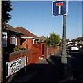
Wallisdown: Acton Road
Acton Road is a dead-end road beyond this last junction, following a 90º left turn which can be seen in the background. Behind us are houses, including some older cottages, while ahead it is bungalows.
The sign is the standard Bournemouth nameplate from the 1980s, affixed with tubular steel which protrudes at each side. It is in pretty good condition for its age although the no-through-road sign to the right has almost faded to nothing. Its message is helpfully repeated on a lamppost.
This is photo no.4 of a series of 451 in my coronavirus lockdown walking project:
See https://www.geograph.org.uk/article/My-2020-Coronavirus-Lockdown-walking-project for the complete set of photos.
Image: © Chris Downer
Taken: 14 Apr 2020
0.08 miles
4
Wallisdown, Bournemouth
This is mainly a residential area.
Image: © Stuart Buchan
Taken: 9 Apr 2006
0.10 miles
5
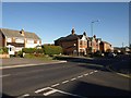
Kinson Road, Wallisdown
Different periods of housing adjacent to each other on the west side of the road, which links the Wallisdown Roundabout on the A3049 to Kinson, two and a half kilometres to the north.
Image: © Derek Harper
Taken: 12 Oct 2009
0.13 miles
6
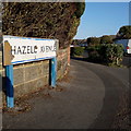
Ensbury Park: Hazell Avenue
Looking around the corner from Noel Road down Hazell Avenue from its top end. We glimpse the bungalows which are prevalent in this area, and also the low hedges which separate each pavement from the carriageway.
The sign is of a design that became prevalent in Bournemouth around 1990 and was in use for most of that decade. Many are starting to look a bit shabby now, and this one is a prime example of both deteriorations: the blue border fading and the white surface unpeeling.
This is photo no.181 of a series of 453 in my coronavirus lockdown walking project:
See https://www.geograph.org.uk/article/My-2020-Coronavirus-Lockdown-walking-project for the complete set of photos.
Image: © Chris Downer
Taken: 14 Apr 2020
0.13 miles
7
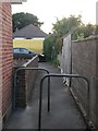
Wallisdown: footpath N01 emerges at the end of Acton Road
The opposite view of the same double barrier in Image As can be seen, Acton Road culminates in an abrupt dead end. There is no turning circle; the road just stops at the hedge.
See Image for the view towards us from a little way along the road.
Image: © Chris Downer
Taken: 8 Jun 2016
0.14 miles
8
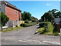
Wallisdown: footpath N02 and Talbot Mews from Alton Road
The modern development Talbot Mews almost but not quite encroaches on the route of footpath N02 to Wallisdown Road. We can see ahead that the original course of the footpath is still available, but is probably little used because there is an opening from the roadway a few yards ahead - see Image
Image: © Chris Downer
Taken: 3 Jul 2016
0.14 miles
9
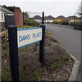
East Howe: Daws Place
A modern, gated, infill development of bungalows off Daws Avenue.
The sign is of the ilk of an official council one, but most of the signs like these have the abstract council logo of 2010-15 above the name. I'm not sure whether its absence denotes that the road is private and not adopted.
This is photo no.102 of a series of 453 in my coronavirus lockdown walking project:
See https://www.geograph.org.uk/article/My-2020-Coronavirus-Lockdown-walking-project for the complete set of photos.
Image: © Chris Downer
Taken: 18 Apr 2020
0.14 miles
10
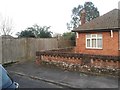
Wallisdown: footpath N01 from the dead end of Acton Road
Acton Road comes to an abrupt dead end but, alongside the last bungalow, a public footpath heads for Priestley Road, the next parallel road behind the bungalow.
See Image for the opposing view towards us, with links to further photos along the route.
Image: © Chris Downer
Taken: 2 Mar 2017
0.15 miles