Wallisdown: Acton Road
Introduction
The photograph on this page of Wallisdown: Acton Road by Chris Downer as part of the Geograph project.
The Geograph project started in 2005 with the aim of publishing, organising and preserving representative images for every square kilometre of Great Britain, Ireland and the Isle of Man.

There are currently over 7.5m images from over 14,400 individuals and you can help contribute to the project by visiting https://www.geograph.org.uk
Wallisdown: Acton Road
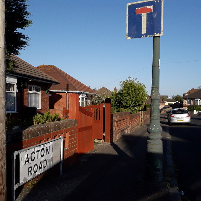
Image: © Chris Downer Taken: 14 Apr 2020
Acton Road is a dead-end road beyond this last junction, following a 90º left turn which can be seen in the background. Behind us are houses, including some older cottages, while ahead it is bungalows. The sign is the standard Bournemouth nameplate from the 1980s, affixed with tubular steel which protrudes at each side. It is in pretty good condition for its age although the no-through-road sign to the right has almost faded to nothing. Its message is helpfully repeated on a lamppost. This is photo no.4 of a series of 451 in my coronavirus lockdown walking project: See https://www.geograph.org.uk/article/My-2020-Coronavirus-Lockdown-walking-project for the complete set of photos.
Images are licensed for reuse under creativecommons.org/licenses/by-sa/2.0
Image Location
Latitude
50.749344
Longitude
-1.905829