IMAGES TAKEN NEAR TO
Hodgson Lane, BRADFORD, BD11 1BN
Introduction
This page details the photographs taken nearby to Hodgson Lane, BD11 1BN by members of the Geograph project.
The Geograph project started in 2005 with the aim of publishing, organising and preserving representative images for every square kilometre of Great Britain, Ireland and the Isle of Man.

There are currently over 7.5m images from over14,400 individuals and you can help contribute to the project by visiting https://www.geograph.org.uk
Image Map
Images are licensed for reuse under creativecommons.org/licenses/by-sa/2.0
Notes
- Clicking on the map will re-center to the selected point.
- The higher the marker number, the further away the image location is from the centre of the postcode.
Image Listing (73 Images Found)
Images are licensed for reuse under creativecommons.org/licenses/by-sa/2.0
Image
Details
Distance
1
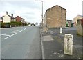
Whitehall Road - viewed from Hodgson Lane
Image: © Betty Longbottom
Taken: 13 Sep 2011
0.03 miles
2
Hodgson Lane - Whitehall Road East
Image: © Betty Longbottom
Taken: 31 Oct 2008
0.03 miles
3
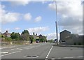
The A58 at the Birkenshaw / Drighlington boundary
The closed-off road on the right is Hodgson Lane, superseded as a through route by the Drighlington bypass road. See Image for a close view of the boundary stone.
Image: © Humphrey Bolton
Taken: 30 Mar 2010
0.03 miles
4
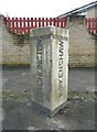
Boundary stone on the A58
Birkenshaw and Drighlington both had Urban District Councils until 1937, when they were absorbed by Spenborough and Morley respectively.
Image: © Humphrey Bolton
Taken: 30 Mar 2010
0.03 miles
5
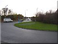
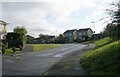
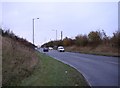
Drighlington Bypass, west of the A58
This shows part of the A58 roundabout and the western section of the A650 Drighlington bypass.
Image: © Humphrey Bolton
Taken: 28 Nov 2005
0.03 miles
6
A650 to Wakefield - viewed from Whitehall Road
Image: © Betty Longbottom
Taken: 13 Sep 2011
0.06 miles
8
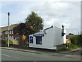
The Dolphin, Whitehall Road, Drighlington
A fish and chip takeaway.
Image: © Stephen Craven
Taken: 5 Sep 2020
0.08 miles
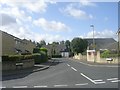
9
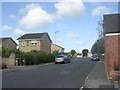
Hodgson Lane - viewed from Whitehall Grove
Image: © Betty Longbottom
Taken: 13 Sep 2011
0.08 miles
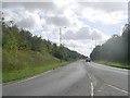
10
Drighlington Bypass, East of the A58
Whether a town has a bypass sometimes depends on whether an easy route is available. In this case a disused railway helped. A single carriageway has proved to be quite adequate, the queues being at the eastern end where it joins the A62 roundabout immediately after the sliproad from the M62.
Image: © Humphrey Bolton
Taken: 28 Nov 2005
0.09 miles