
IMAGES TAKEN NEAR TO
Gordale Close, BARNOLDSWICK, BB18 5RF
Introduction
This page details the photographs taken nearby to Gordale Close, BB18 5RF by members of the Geograph project.
The Geograph project started in 2005 with the aim of publishing, organising and preserving representative images for every square kilometre of Great Britain, Ireland and the Isle of Man.

There are currently over 7.5m images from over14,400 individuals and you can help contribute to the project by visiting https://www.geograph.org.uk
Image Map
Images are licensed for reuse under creativecommons.org/licenses/by-sa/2.0
Notes
- Clicking on the map will re-center to the selected point.
- The higher the marker number, the further away the image location is from the centre of the postcode.
Image Listing (225 Images Found)
Images are licensed for reuse under creativecommons.org/licenses/by-sa/2.0
Image
Details
Distance
1
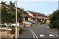
Priory Way, Barnoldswick (4)
Near the far end of the stem of the Priory Way 'T'. Most new residential roads are now provided with speed bumps from the start, as here.
Image: © Dr Neil Clifton
Taken: 8 Jul 2007
0.04 miles
2
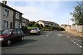
Top of Harper Street, Barnoldswick, Yorkshire
Priory Way comes in from the right near to the camera. Higher up, Harper street reaches its end, with Pennine Way to the left and Monkroyd Avenue to the right.
Image: © Dr Neil Clifton
Taken: 8 Jul 2007
0.06 miles
3
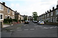
Hollins Road, Barnoldswick, Yorkshire
Hollins Road is a short street connecting Pennine Way (where the photographer is standing) with the end of Federation Street.
Image: © Dr Neil Clifton
Taken: 8 Jul 2007
0.06 miles
4

Top of Hollins Road from Taylor Street, Barnoldswick
From its northern end, Taylor Street climbs to an elevated position from where it affords good views of the surroundings. This is looking northwards to the houses at the top end of Hollins Road.
Image: © Dr Neil Clifton
Taken: 8 Jul 2007
0.06 miles
5
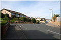
Pennine Way/ Harper Street/ Monkroyd Avenue junction, Barnoldswick
Harper Street behind the photographer, Monkroyd Avenue in front of him and to the right, and Pennine Way off to the left.
Image: © Dr Neil Clifton
Taken: 8 Jul 2007
0.07 miles
6
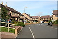
Priory Way, Barnoldswick (3)
This is on the 'stem' of the T-shaped Priory Way, looking east to the junction.
Image: © Dr Neil Clifton
Taken: 8 Jul 2007
0.08 miles
7
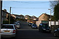
Barnoldswick: Harper Street
Looking southwest from its junction with Federation Street.
Image: © Dr Neil Clifton
Taken: 10 Apr 2011
0.09 miles
9
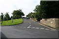
North end of Taylor Street, Barnoldswick.
This is looking south into Taylor Street, with Pennine Way on the right, and Butts on the left. The other end of Taylor Street is a dead end for motor vehicles.
Image: © Dr Neil Clifton
Taken: 8 Jul 2007
0.11 miles
10
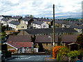
Barnoldswick: View from Monkroyd Avenue
Image: © Dr Neil Clifton
Taken: 3 May 2015
0.11 miles