
IMAGES TAKEN NEAR TO
Lower Road, TEMPLECOMBE, BA8 0BX
Introduction
This page details the photographs taken nearby to Lower Road, BA8 0BX by members of the Geograph project.
The Geograph project started in 2005 with the aim of publishing, organising and preserving representative images for every square kilometre of Great Britain, Ireland and the Isle of Man.

There are currently over 7.5m images from over14,400 individuals and you can help contribute to the project by visiting https://www.geograph.org.uk
Image Map
Images are licensed for reuse under creativecommons.org/licenses/by-sa/2.0
Notes
- Clicking on the map will re-center to the selected point.
- The higher the marker number, the further away the image location is from the centre of the postcode.
Image Listing (9 Images Found)
Images are licensed for reuse under creativecommons.org/licenses/by-sa/2.0
Image
Details
Distance
1
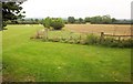
Farmland near Horsington
From beside Lower Road next to St Margaret's Hall, with a playing field on the left.
Image: © Derek Harper
Taken: 14 Sep 2013
0.07 miles
2
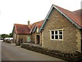
St Margaret?s Hall, Horsington
Horsington Village Hall, as it is also known, was built in 1907.
Image: © Derek Harper
Taken: 14 Sep 2013
0.09 miles
3
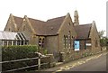
Horsington Church of England Primary School
The building dates from 1855-56 and is described at http://list.english-heritage.org.uk/resultsingle.aspx?uid=1238115&searchtype=mapsearch . It must be difficult to teach and learn a C21 curriculum in a building designed for a different era.
Image: © Derek Harper
Taken: 14 Sep 2013
0.12 miles
4
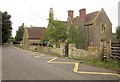
Horsington Church of England Primary School
A view of Image] from down the road.
Image: © Derek Harper
Taken: 14 Sep 2013
0.12 miles
5
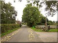
Lower Road, Peckholds Ash
The lower road between South Cheriton and Horsington (the higher is the A357) passes the war memorial, behind which is a car park, and approaches Horsington School.
Image: © Derek Harper
Taken: 14 Sep 2013
0.15 miles
6
Field at Horsington
This is the southern part of the field seen on the right of Image The view quickly crosses into Image
Image: © Derek Harper
Taken: 14 Sep 2013
0.19 miles
7
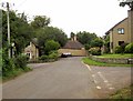
Lower Road, Horsington
The road from South Cheriton passes Back lane on the right, and the West Lodge to Horsington Manor on the left. Ahead is the manor's stable complex http://list.english-heritage.org.uk/resultsingle.aspx?uid=1238068&searchtype=mapsearch and Stable Cottage.
Image: © Derek Harper
Taken: 14 Sep 2013
0.22 miles
8
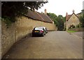
Stable block, Horsington
A closer view of the street side of the listed stable buildings of Horsington Manor, also shown in Image] http://list.english-heritage.org.uk/resultsingle.aspx?uid=1238068&searchtype=mapsearch .
Image: © Derek Harper
Taken: 14 Sep 2013
0.22 miles
9
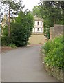
Horsington Manor
The merest glimpse of the C18 house http://list.english-heritage.org.uk/resultsingle.aspx?uid=1238067&searchtype=mapsearch from Lower Road past the West Lodge. "Built between 1753 and 1770 by the Spencer family - Parson Woodforde visiting it on 4 July 1770 said 'Mr Spencer has a noble house and everything in the neatest manner'".
Image: © Derek Harper
Taken: 14 Sep 2013
0.24 miles