
IMAGES TAKEN NEAR TO
Pines Way, RADSTOCK, BA3 3EZ
Introduction
This page details the photographs taken nearby to Pines Way, BA3 3EZ by members of the Geograph project.
The Geograph project started in 2005 with the aim of publishing, organising and preserving representative images for every square kilometre of Great Britain, Ireland and the Isle of Man.

There are currently over 7.5m images from over14,400 individuals and you can help contribute to the project by visiting https://www.geograph.org.uk
Image Map
Images are licensed for reuse under creativecommons.org/licenses/by-sa/2.0
Notes
- Clicking on the map will re-center to the selected point.
- The higher the marker number, the further away the image location is from the centre of the postcode.
Image Listing (66 Images Found)
Images are licensed for reuse under creativecommons.org/licenses/by-sa/2.0
Image
Details
Distance
2
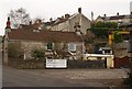
Buildings by Frome Road, Radstock
On the right is Ryman’s Engineering Yard. At this point a railway line formerly crossed the A362 (Frome Road) and the tracks remain at bottom right. Above on the hillside are some of the eight-dwelling-long C19 terraces comprising Carlingford Terrace.
Image: © Derek Harper
Taken: 25 Feb 2009
0.10 miles
4
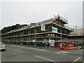
Hope House health Centre, Radstock, under construction
Image: © Jonathan Thacker
Taken: 23 Sep 2021
0.11 miles
6
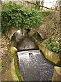
Kilmersdon Brook
The brook tumbles over a small weir as it approaches the Frome Road east of Radstock town centre. The ivy-covered bridge carries a road to Image
Image: © Derek Harper
Taken: 25 Feb 2009
0.12 miles
7
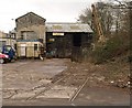
Ryman?s Engineering Yard, Radstock
A fragment of Radstock's industrial history. In the foreground are the rails mentioned in Image Clearly there was a level crossing here across Frome Road. The tracks ran through a cutting which is now a SNCI (Site of Nature Conservation Importance).
Image: © Derek Harper
Taken: 25 Feb 2009
0.13 miles
8
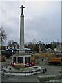
Radstock War Memorial and Miners' Memorial Garden
The Radstock War Memorial in its new location as part of the Miners' Memorial Garden. Former Kilmersdon Pit Wheel in background.
Image: © Nigel Shoosmith
Taken: 21 Dec 2008
0.14 miles
9
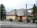
Kingdom Hall of Jehovah's Witnesses, Radstock
On the north side of Waterloo Road.
Image: © Christine Johnstone
Taken: 2 Apr 2018
0.14 miles
10
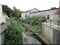
The Wellow Brook at Radstock
Heavily engineered. Looking downstream.
Image: © Jonathan Thacker
Taken: 23 Sep 2021
0.14 miles