Buildings by Frome Road, Radstock
Introduction
The photograph on this page of Buildings by Frome Road, Radstock by Derek Harper as part of the Geograph project.
The Geograph project started in 2005 with the aim of publishing, organising and preserving representative images for every square kilometre of Great Britain, Ireland and the Isle of Man.

There are currently over 7.5m images from over 14,400 individuals and you can help contribute to the project by visiting https://www.geograph.org.uk
Buildings by Frome Road, Radstock
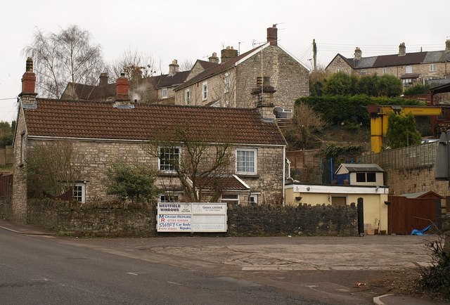
Image: © Derek Harper Taken: 25 Feb 2009
On the right is Ryman’s Engineering Yard. At this point a railway line formerly crossed the A362 (Frome Road) and the tracks remain at bottom right. Above on the hillside are some of the eight-dwelling-long C19 terraces comprising Carlingford Terrace.
Images are licensed for reuse under creativecommons.org/licenses/by-sa/2.0
Image Location
Latitude
51.291489
Longitude
-2.443943