
IMAGES TAKEN NEAR TO
High Street, BATH, BA1 7NS
Introduction
This page details the photographs taken nearby to High Street, BA1 7NS by members of the Geograph project.
The Geograph project started in 2005 with the aim of publishing, organising and preserving representative images for every square kilometre of Great Britain, Ireland and the Isle of Man.

There are currently over 7.5m images from over14,400 individuals and you can help contribute to the project by visiting https://www.geograph.org.uk
Image Map
Images are licensed for reuse under creativecommons.org/licenses/by-sa/2.0
Notes
- Clicking on the map will re-center to the selected point.
- The higher the marker number, the further away the image location is from the centre of the postcode.
Image Listing (31 Images Found)
Images are licensed for reuse under creativecommons.org/licenses/by-sa/2.0
Image
Details
Distance
1
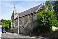
Congregational Chapel, Batheaston
Now converted into residential apartments.
Image: © Bill Boaden
Taken: 25 Jul 2016
0.00 miles
2
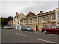
Houses on the Fosse Way
These houses and offices and shops are on the London Road East close to Stam Bridge where the old Roman road crosses St Catherines brook just before it reaches Batheaston where the road climbs up out of the valley of the Avon.
Image: © Nigel Mykura
Taken: 16 Sep 2012
0.06 miles
3
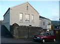
Former telephone exchange, Fenthouse Hill, Batheaston
My assumption - it is called 'The Old Exchange'.
Image: © Humphrey Bolton
Taken: 16 Nov 2010
0.06 miles
4
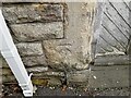
Ordnance Survey Cut Mark
This OS cut mark can be found on the building at Brow Hill. It marks a point 44.525m above mean sea level.
Image: © Adrian Dust
Taken: 24 May 2024
0.06 miles
5
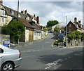
2008 : Road to St.Catherine
At the junction with London Road. The Limestone Link follows this valley but does not keep to the road. Care needed if you are driving, narrow, sharp bends and steep in places, better by leg power.
Image: © Maurice Pullin
Taken: 20 May 2008
0.06 miles
6

2008 : Batheaston entertainments and Post Office
The Post Office squeezed between the George & Dragon and the Fat Friar.
Its Batheaston for the good life.
Not sure of the category in the end settled for "Post Office" as it is in the middle.
Image: © Maurice Pullin
Taken: 20 May 2008
0.07 miles
7
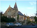
Former chapel, High Street, Batheaston
This is evidently a house now, but with minimal alterations - the roof-lights and perhaps the elaborate hinges on the door under the steeple.
Image: © Humphrey Bolton
Taken: 16 Nov 2010
0.08 miles
8
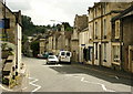
2008 : London Road, Batheaston
Before the coming of the bypass this was the A4 and you would need to be here at about 4 a.m. to see it like this.
OS Explorer 155 indicates a post office. Unseen now it is probably closed. There is still a post box in the wall on the other side of the road and a newsagents just beyond.
Image: © Maurice Pullin
Taken: 20 May 2008
0.08 miles
9

Bridge over the Avon
River Avon Bridge, near Bathampton.
Image: © Wayland Smith
Taken: 30 Aug 2020
0.08 miles
10

Batheaston Gardens flood
This bridge over the Avon for the new cycleway link between Batheaston and Bathampton was installed on 20th December 2013. The photo was taken on 24th December after the Avon flooded extensively throughout Wiltshire, Bathford and Batheaston. In the foreground is Batheaston Gardens.
Image: © Mary Kelly
Taken: 24 Dec 2013
0.08 miles