
IMAGES TAKEN NEAR TO
Barn Close, STREET, BA16 0BG
Introduction
This page details the photographs taken nearby to Barn Close, BA16 0BG by members of the Geograph project.
The Geograph project started in 2005 with the aim of publishing, organising and preserving representative images for every square kilometre of Great Britain, Ireland and the Isle of Man.

There are currently over 7.5m images from over14,400 individuals and you can help contribute to the project by visiting https://www.geograph.org.uk
Image Map
Images are licensed for reuse under creativecommons.org/licenses/by-sa/2.0
Notes
- Clicking on the map will re-center to the selected point.
- The higher the marker number, the further away the image location is from the centre of the postcode.
Image Listing (292 Images Found)
Images are licensed for reuse under creativecommons.org/licenses/by-sa/2.0
Image
Details
Distance
1

Barn Close, Street, Somerset
From the corner of Farm Road.
Image: © Jaggery
Taken: 27 Sep 2016
0.01 miles
2
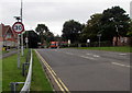
Start of the 30 zone, Farm Road, Street, Somerset
The 40mph speed limit on the A39 Westway behind the camera drops to 30mph on Farm Road.
Image: © Jaggery
Taken: 27 Sep 2016
0.03 miles
3

Half and half house in Street, Somerset
The house on the corner of Farm Road and Barn Close has a stone ground floor with a brick first floor.
Image: © Jaggery
Taken: 27 Sep 2016
0.03 miles
4
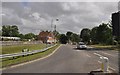
Street : Farm Road
Farm Road in Street from West Way A39.
Image: © Lewis Clarke
Taken: 15 Jun 2012
0.03 miles
5

Street : Farm Road
Farm Road in Street from the A39 West Way.
Image: © Lewis Clarke
Taken: 15 Jun 2012
0.04 miles
6
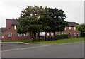
Northleaze House, Street, Somerset
Retirement housing viewed across Farm Road.
Image: © Jaggery
Taken: 27 Sep 2016
0.05 miles
7
![Street houses [1]](https://s3.geograph.org.uk/geophotos/06/37/17/6371763_b60731e7_120x120.jpg)
Street houses [1]
Probably the oldest building in Street, The Grange has also been known as Street House. Built before 1539 as a part of Glastonbury Abbey, the house was much rebuilt and aggrandized in the 17th century and was refronted circa 1810. Now the offices of the Alfred Gillett Trust, a charity which cares for the heritage collections of C & J Clark Ltd the family shoemaking company. Listed, grade II, with details at: https://historicengland.org.uk/listing/the-list/list-entry/1176002
The village of Street is situated at the end of the Polden Hills on a dry spot in the Somerset Levels. There is evidence of Roman settlement. In the mid 17th century, the Society of Friends was established in Street and one of the Quaker families who settled here were the Clarks. In 1825 James Clark began the production of slippers and later shoes and boots. The business flourished under his son, William, but profits were ploughed back into employee welfare, housing and education. Much of the housing in the centre of Street was built by the company.
Image: © Michael Dibb
Taken: 21 Sep 2019
0.05 miles
8
![Street houses [2]](https://s1.geograph.org.uk/geophotos/06/37/17/6371765_368bf0ce_120x120.jpg)
Street houses [2]
Probably the oldest building in Street, The Grange, seen here from Clark's Shopping Village, has also been known as Street House. Built before 1539 as a part of Glastonbury Abbey, the house was much rebuilt and aggrandized in the 17th century and was refronted circa 1810. Now the offices of the Alfred Gillett Trust, a charity which cares for the heritage collections of C & J Clark Ltd the family shoemaking company. Listed, grade II, with details at: https://historicengland.org.uk/listing/the-list/list-entry/1176002
The village of Street is situated at the end of the Polden Hills on a dry spot in the Somerset Levels. There is evidence of Roman settlement. In the mid 17th century, the Society of Friends was established in Street and one of the Quaker families who settled here were the Clarks. In 1825 James Clark began the production of slippers and later shoes and boots. The business flourished under his son, William, but profits were ploughed back into employee welfare, housing and education. Much of the housing in the centre of Street was built by the company.
Image: © Michael Dibb
Taken: 21 Sep 2019
0.05 miles
9
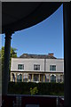
The Grange, Street
Now slightly overwhelmed by the Clarks Shopping Village from where this picture was taken, The Grange is a Grade II listed property. Originally a house connected with the Abbey at Wells it was rebuilt for Strode family circa 1650 and then refronted for Brown family in around 1810. It is now occupied by the Alfred Gillett Trust who are the custodians of the Clark's family and business heritage collections and is open to the public on weekdays.
Image: © Colin Cheesman
Taken: 28 Jul 2014
0.05 miles
10
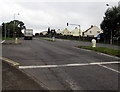
Westway junction in Street, Somerset
The main road is the A39 Westway. Traffic lights control this junction
with Farm Road on the left, the way to Clarks Village and the town centre.
Image: © Jaggery
Taken: 27 Sep 2016
0.06 miles