The Grange, Street
Introduction
The photograph on this page of The Grange, Street by Colin Cheesman as part of the Geograph project.
The Geograph project started in 2005 with the aim of publishing, organising and preserving representative images for every square kilometre of Great Britain, Ireland and the Isle of Man.

There are currently over 7.5m images from over 14,400 individuals and you can help contribute to the project by visiting https://www.geograph.org.uk
The Grange, Street
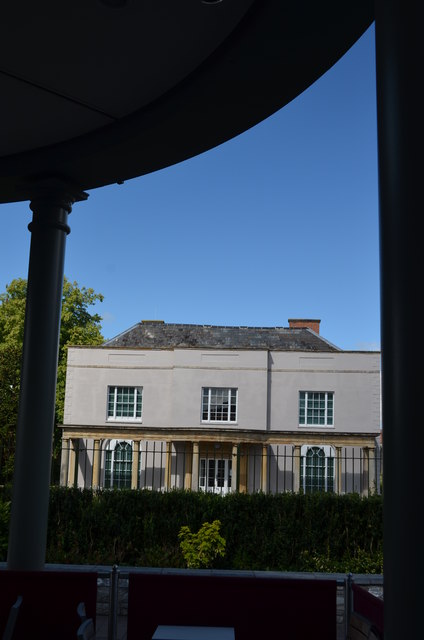
Image: © Colin Cheesman Taken: 28 Jul 2014
Now slightly overwhelmed by the Clarks Shopping Village from where this picture was taken, The Grange is a Grade II listed property. Originally a house connected with the Abbey at Wells it was rebuilt for Strode family circa 1650 and then refronted for Brown family in around 1810. It is now occupied by the Alfred Gillett Trust who are the custodians of the Clark's family and business heritage collections and is open to the public on weekdays.
Images are licensed for reuse under creativecommons.org/licenses/by-sa/2.0
Image Location
Latitude
51.129207
Longitude
-2.740916