
IMAGES TAKEN NEAR TO
Cranhill Road, BATH, BA1 2YF
Introduction
This page details the photographs taken nearby to Cranhill Road, BA1 2YF by members of the Geograph project.
The Geograph project started in 2005 with the aim of publishing, organising and preserving representative images for every square kilometre of Great Britain, Ireland and the Isle of Man.

There are currently over 7.5m images from over14,400 individuals and you can help contribute to the project by visiting https://www.geograph.org.uk
Image Map
Images are licensed for reuse under creativecommons.org/licenses/by-sa/2.0
Notes
- Clicking on the map will re-center to the selected point.
- The higher the marker number, the further away the image location is from the centre of the postcode.
Image Listing (77 Images Found)
Images are licensed for reuse under creativecommons.org/licenses/by-sa/2.0
Image
Details
Distance
1
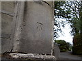
Benchmark on the entrance to a private nursing home
The benchmark can be found along Weston Road and in the Benchmark Database: http://www.bench-marks.org.uk/bm40843 .
Image: © Neil Owen
Taken: 6 Jan 2012
0.09 miles
2
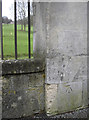
Benchmark in Weston Road
There are three cutmarks on the pillars at the bottom of the golf course. This is the western one; see Image] for the central, and http://www.bench-marks.org.uk/bm40844 for the entry in the Benchmark Database
Image: © Neil Owen
Taken: 6 Jan 2012
0.10 miles
3
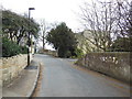
The Cotswold Way on Sion Hill, Bath
The Cotswold Way, day five 2:56pm
Image: © Ian S
Taken: 21 Apr 2013
0.11 miles
4
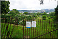
High Common Allotments
Council-run allotments with a view over part of Bath below.
Image: © Bill Boaden
Taken: 21 Jul 2016
0.11 miles
5
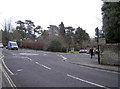
Roundabout at the top of the hill
Adjoining the Weston Road and Park Lane is the vehicular entrance to Royal Victoria Park. The eagle-eyed viewers will spot a benchmark on the wall to the left. See Image] for a close view.
Image: © Neil Owen
Taken: 6 Jan 2012
0.11 miles
6
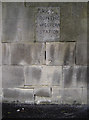
Just a little walk down the hill
A handy milestone in a wall opposite the Royal Victoria Park in Bath. Presumably this was a more exclusive part of the town when the railways were first established, and more likely to be the home of typical passengers.
Image: © Neil Owen
Taken: 6 Jan 2012
0.12 miles
7
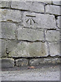
Benchmark on Weston Road
Close to the roundabout with Park Lane, this cutmark was levelled at 52.7m above mean sea level. See http://www.bench-marks.org.uk/bm40842 for the entry in the Benchmark Database, and Image] for a wider view.
Image: © Neil Owen
Taken: 6 Jan 2012
0.12 miles
9

The Cotswold Way at High Common, Bath
The Cotswold Way, day five 2:57pm
Image: © Ian S
Taken: 21 Apr 2013
0.12 miles
10
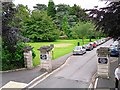
Entrance to Royal Victoria Park from north end of Park Lane
Viewed from an open top bus.
Image: © Rose and Trev Clough
Taken: 10 Jul 2012
0.12 miles