Benchmark on Weston Road
Introduction
The photograph on this page of Benchmark on Weston Road by Neil Owen as part of the Geograph project.
The Geograph project started in 2005 with the aim of publishing, organising and preserving representative images for every square kilometre of Great Britain, Ireland and the Isle of Man.

There are currently over 7.5m images from over 14,400 individuals and you can help contribute to the project by visiting https://www.geograph.org.uk
Benchmark on Weston Road
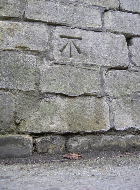
Image: © Neil Owen Taken: 6 Jan 2012
Close to the roundabout with Park Lane, this cutmark was levelled at 52.7m above mean sea level. See http://www.bench-marks.org.uk/bm40842 for the entry in the Benchmark Database, and Image] for a wider view.
Images are licensed for reuse under creativecommons.org/licenses/by-sa/2.0
Image Location
Latitude
51.389189
Longitude
-2.378492