
IMAGES TAKEN NEAR TO
Weston Road, BATH, BA1 2XB
Introduction
This page details the photographs taken nearby to Weston Road, BA1 2XB by members of the Geograph project.
The Geograph project started in 2005 with the aim of publishing, organising and preserving representative images for every square kilometre of Great Britain, Ireland and the Isle of Man.

There are currently over 7.5m images from over14,400 individuals and you can help contribute to the project by visiting https://www.geograph.org.uk
Image Map
Images are licensed for reuse under creativecommons.org/licenses/by-sa/2.0
Notes
- Clicking on the map will re-center to the selected point.
- The higher the marker number, the further away the image location is from the centre of the postcode.
Image Listing (13 Images Found)
Images are licensed for reuse under creativecommons.org/licenses/by-sa/2.0
Image
Details
Distance
1
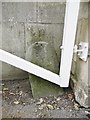
Old Boundary Marker by Park Gardens, Weston Road, Bath
Boundary Marker by the UC road, in parish of Bath (Bath and North East Somerset District), Park Gardens, North end of private road next to gateway, off Weston Road.
Surveyed
Milestone Society National ID: SO_BH01bm.
Image: © Milestone Society
Taken: Unknown
0.13 miles
2

Bath, Park Gardens
Private road with spacious houses.
Image: © Mike Faherty
Taken: 8 Mar 2015
0.16 miles
3
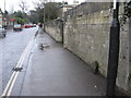
One mile to the Guildhall
A very weathered milestone on Weston Lane. The beginning of Victoria Park can be seen in the distance.
Image: © HelenK
Taken: 18 Mar 2011
0.19 miles
4
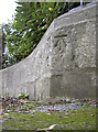
Benchmark in Park Gardens
A cut benchmark, as listed in the Benchmark Database http://www.bench-marks.org.uk/bm40838 , on a short wall in Park Gardens and close to the entrance mark. See Image] for a view of the entrance.
Image: © Neil Owen
Taken: 6 Jan 2012
0.19 miles
5
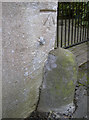
Benchmark, Audley Park Road
A well-defined cutmark on an entrance gate in Audley Park Road - see http://www.bench-marks.org.uk/bm40836 for the Benchmark Database.
Image: © Neil Owen
Taken: 6 Jan 2012
0.21 miles
6

Old Milestone, Park Lane, Bath
The milestone is located at the junction with Weston Road, high up in the stone garden wall of the corner house, on the west side of the road. Parish of Bath (Bath and North East Somerset District). Carved stone post with metal attachments, erected by the Bath turnpike trust in the 19th century.
Inscription reads:-
I MILE
FROM THE
G WESTERN
R STATION
Milestone Society National ID: SO_GWR01
Image: © Jon Heyes
Taken: Unknown
0.21 miles
7
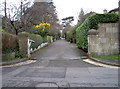
Southern entrance to Park Gardens
This private road has a gate for security and on the right-hand pillar is a benchmark. See Image] for a closer view.
Image: © Neil Owen
Taken: 6 Jan 2012
0.21 miles
8
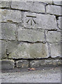
Benchmark on Weston Road
Close to the roundabout with Park Lane, this cutmark was levelled at 52.7m above mean sea level. See http://www.bench-marks.org.uk/bm40842 for the entry in the Benchmark Database, and Image] for a wider view.
Image: © Neil Owen
Taken: 6 Jan 2012
0.21 miles
9
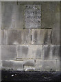
Just a little walk down the hill
A handy milestone in a wall opposite the Royal Victoria Park in Bath. Presumably this was a more exclusive part of the town when the railways were first established, and more likely to be the home of typical passengers.
Image: © Neil Owen
Taken: 6 Jan 2012
0.21 miles
10
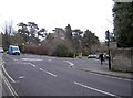
Roundabout at the top of the hill
Adjoining the Weston Road and Park Lane is the vehicular entrance to Royal Victoria Park. The eagle-eyed viewers will spot a benchmark on the wall to the left. See Image] for a close view.
Image: © Neil Owen
Taken: 6 Jan 2012
0.22 miles