
IMAGES TAKEN NEAR TO
Vallis Way, FROME, BA11 3BH
Introduction
This page details the photographs taken nearby to Vallis Way, BA11 3BH by members of the Geograph project.
The Geograph project started in 2005 with the aim of publishing, organising and preserving representative images for every square kilometre of Great Britain, Ireland and the Isle of Man.

There are currently over 7.5m images from over14,400 individuals and you can help contribute to the project by visiting https://www.geograph.org.uk
Image Map
Images are licensed for reuse under creativecommons.org/licenses/by-sa/2.0
Notes
- Clicking on the map will re-center to the selected point.
- The higher the marker number, the further away the image location is from the centre of the postcode.
Image Listing (69 Images Found)
Images are licensed for reuse under creativecommons.org/licenses/by-sa/2.0
Image
Details
Distance
1
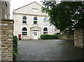
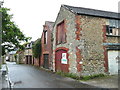
Former chapel, Haigh's Street, Trinity
Image: © Humphrey Bolton
Taken: 19 Sep 2013
0.02 miles
2
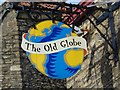
Sign for the Old Globe Inn, Frome
The sign for Image
Image: © Maigheach-gheal
Taken: 16 Mar 2009
0.03 miles
3
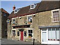
The Old Globe Inn, Frome
A family run pub at the heart of the community.
Image: © Maigheach-gheal
Taken: 16 Mar 2009
0.04 miles
4
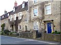
Vallis Way, Frome
A row of 17th century merchants houses, restored in 1988.
Image: © Maigheach-gheal
Taken: 16 Mar 2009
0.04 miles
6
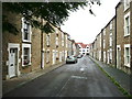
Haigh's Street, Trinity
This suburb is remarkable in having been developed in the late 17C. Several of these houses are listed, Grade II, and were built at the end of the 17C or the beginning of the 18C.
Image: © Humphrey Bolton
Taken: 19 Sep 2013
0.05 miles
7
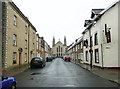
Trinity Street
The Holy Trinity Church keeps a watchful eye on Trinity Street. The church was built in 1857, Architect: E E Goodridge, and is Grade II* listed. The street, however, is the main street of the late 17C Trinity suburb. Either the suburb was renamed in the 19C or there was an earlier church here.
Image: © Humphrey Bolton
Taken: 19 Sep 2013
0.11 miles
8
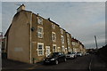
Horton Street, Frome
Built in the first half of the 18th Century as Frome expanded and demand for housing for the workers in the town's booming textile industry, Horton Street and other streets in this area are more properly part of the Newtown area of Frome. The road links Robin Street and Vallis Street.
Image: © John Winder
Taken: 27 Jan 2015
0.11 miles
9
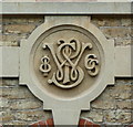
Datestone on the Selwood Printing Works
Image: © Humphrey Bolton
Taken: 19 Sep 2013
0.11 miles
10
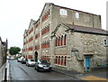
The former Selwood Printing Works
A remarkable industrial building built between 1866 and 1870, now converted to apartments. Surprisingly it is not a listed building.
Image: © Humphrey Bolton
Taken: 19 Sep 2013
0.11 miles