IMAGES TAKEN NEAR TO
Tippendell Lane, ST. ALBANS, AL2 2HE
Introduction
This page details the photographs taken nearby to Tippendell Lane, AL2 2HE by members of the Geograph project.
The Geograph project started in 2005 with the aim of publishing, organising and preserving representative images for every square kilometre of Great Britain, Ireland and the Isle of Man.

There are currently over 7.5m images from over14,400 individuals and you can help contribute to the project by visiting https://www.geograph.org.uk
Image Map
Images are licensed for reuse under creativecommons.org/licenses/by-sa/2.0
Notes
- Clicking on the map will re-center to the selected point.
- The higher the marker number, the further away the image location is from the centre of the postcode.
Image Listing (17 Images Found)
Images are licensed for reuse under creativecommons.org/licenses/by-sa/2.0
Image
Details
Distance
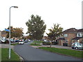
1
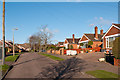
Orchard Drive
1970s bungalows in this large residential area off the North Orbital Road, development of which started in the 1950s.
Image: © Ian Capper
Taken: 2 Feb 2013
0.05 miles
2
Orchard Drive
Housing dating from around 1970 in this large residential area off the North Orbital Road, development of which started in the 1950s.
Image: © Ian Capper
Taken: 2 Feb 2013
0.11 miles
4
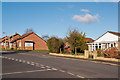
Mayflower Road
1970s bungalows in the large residential area of How Wood off the North Orbital Road, development of which started in the 1950s.
Image: © Ian Capper
Taken: 2 Feb 2013
0.15 miles
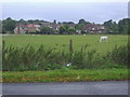
5
Orchard Drive, How Wood
Orchard Drove at How Wood, near St Albans.
The sign attached to the lamp post indicates the route of National Cycle Network route 6.
Image: © Malc McDonald
Taken: 26 Sep 2015
0.15 miles
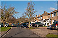
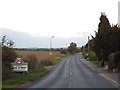
6
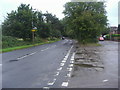
Tippendell Lane
Junction Spooners Drive, Park Street
Image: © David Howard
Taken: 29 Jul 2009
0.16 miles
7
Junction of Penn Road and Tippendell Lane
Image: © David Howard
Taken: 17 Mar 2011
0.16 miles
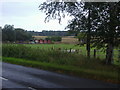
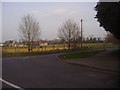
9
Tippendell Lane, Park Street
Tippendell Lane entering Park Street, near St Albans.
Image: © Malc McDonald
Taken: 26 Sep 2015
0.19 miles
10
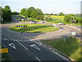
Chiswell Green: A405 North Orbital Road & Tippendell Lane roundabout
Viewed from the footbridge over the North Orbital Road, so named because it was planned and built as a section of one of the pre-M25 Motorway "Ringways" around London. The A405 is actually one of the shortest A roads in the country running from the A41 at Leavesden Green to the roundabout at the eastern end of the M10 Motorway, a distance of no more than about 7 kilometres or about 4½ miles.
Image: © Nigel Cox
Taken: 8 May 2008
0.20 miles