IMAGES TAKEN NEAR TO
Corncroft, HATFIELD, AL10 0JQ
Introduction
This page details the photographs taken nearby to Corncroft, AL10 0JQ by members of the Geograph project.
The Geograph project started in 2005 with the aim of publishing, organising and preserving representative images for every square kilometre of Great Britain, Ireland and the Isle of Man.

There are currently over 7.5m images from over14,400 individuals and you can help contribute to the project by visiting https://www.geograph.org.uk
Image Map
Images are licensed for reuse under creativecommons.org/licenses/by-sa/2.0
Notes
- Clicking on the map will re-center to the selected point.
- The higher the marker number, the further away the image location is from the centre of the postcode.
Image Listing (18 Images Found)
Images are licensed for reuse under creativecommons.org/licenses/by-sa/2.0
Image
Details
Distance
4
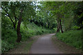
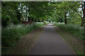
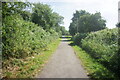
Alban Way final section at Hatfield
Looking remarkably rural although in the suburbs of Hatfield.
Image: © Robert Eva
Taken: 6 May 2017
0.16 miles
5
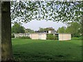
Music Rooms, Mid-Herts Centre for Music and Arts, Birchwood Avenue, Hatfield
Image: © Chris Reynolds
Taken: 23 Apr 2009
0.16 miles
6
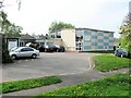
Mid-Herts Centre for Music and Arts, Birchwood Avenue, Hatfield
The centre (see http://www.hertsmusicservice.org.uk/ ) is in a central position in Hertfordshire, and as a result the music rooms are often used for meetings which bring together small numbers of people from all over the county.
The building also contains the offices of the Community Development Agency for Hertfordshire http://www.cdaforherts.org.uk/ . Their offices are behind white parked car on extreme right of the picture.
Image: © Chris Reynolds
Taken: 23 Apr 2009
0.16 miles
8
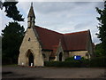
St Luke's Church, Hatfield
Dates from 1877, this church was originally the chapel for the adjoining cemetery
Image: © Jim Osley
Taken: 8 Aug 2010
0.19 miles
9
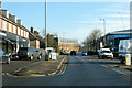
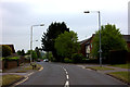
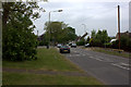
B6426 St Albans Road East, Hatfield
A surprising road name as it is heading east from the modern town centre towards Hertford, the opposite direction to St Albans.
Image: © Robin Webster
Taken: 17 Feb 2019
0.21 miles
10
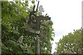
Artwork at the Hatfield end of the Alban Way
Image: © Robert Eva
Taken: 6 May 2017
0.21 miles