IMAGES TAKEN NEAR TO
Craigievar, ALFORD, AB33 8LT
Introduction
This page details the photographs taken nearby to AB33 8LT by members of the Geograph project.
The Geograph project started in 2005 with the aim of publishing, organising and preserving representative images for every square kilometre of Great Britain, Ireland and the Isle of Man.

There are currently over 7.5m images from over14,400 individuals and you can help contribute to the project by visiting https://www.geograph.org.uk
Image Map
Images are licensed for reuse under creativecommons.org/licenses/by-sa/2.0
Notes
- Clicking on the map will re-center to the selected point.
- The higher the marker number, the further away the image location is from the centre of the postcode.
Image Listing (12 Images Found)
Images are licensed for reuse under creativecommons.org/licenses/by-sa/2.0
Image
Details
Distance
1
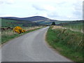
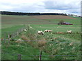
A lang stracht
From the dogleg below Whiteknowes; aimed towards Benquhallie [NJ6008; 464m] in the Corennie Hills ahead.
Image: © Stanley Howe
Taken: 24 Apr 2007
0.05 miles
2
Part of the long stracht west from the Corse O'Neil junction
Image: © Stanley Howe
Taken: 24 Jul 2012
0.07 miles
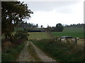
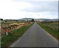
4
Junction for Norham
From the minoe road west of corse O'Neil; with the farm name of what appears to be a near-overgrown green mail-box.
Image: © Stanley Howe
Taken: 24 Jul 2012
0.09 miles
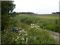
5
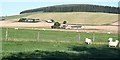
Drainage Ditch
Being explored by sheep on its way down to the Rumblie Burn. Bervie is to the right.
Image: © Stanley Howe
Taken: 24 Apr 2007
0.11 miles
7
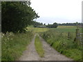
Access to Norham
From the minor road west of Corse O'Neil.
Image: © Stanley Howe
Taken: 24 Jul 2012
0.12 miles
8
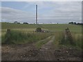
Access to Bervie
From the Corse O'Neil minor road. The prancing horses sign of 2007 Image] is no longer to be seen.
Image: © Stanley Howe
Taken: 24 Jul 2012
0.17 miles
9
Bervie
Looking from the splendidly named West Rumblie to Bervie, and in the distance Wester Leochel Wood on top of the hill.
Image: © Anne Burgess
Taken: 8 Sep 2006
0.21 miles
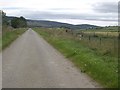
10
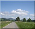
A lang stracht
The minor road between Whiteknowes and Corse O'Neil school.
Image: © Stanley Howe
Taken: 26 Jun 2012
0.22 miles