
IMAGES TAKEN NEAR TO
Maryculter, ABERDEEN, AB12 5FX
Introduction
This page details the photographs taken nearby to AB12 5FX by members of the Geograph project.
The Geograph project started in 2005 with the aim of publishing, organising and preserving representative images for every square kilometre of Great Britain, Ireland and the Isle of Man.

There are currently over 7.5m images from over14,400 individuals and you can help contribute to the project by visiting https://www.geograph.org.uk
Image Map
Images are licensed for reuse under creativecommons.org/licenses/by-sa/2.0
Notes
- Clicking on the map will re-center to the selected point.
- The higher the marker number, the further away the image location is from the centre of the postcode.
Image Listing (16 Images Found)
Images are licensed for reuse under creativecommons.org/licenses/by-sa/2.0
Image
Details
Distance
1
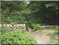
An almost hidden footbridge
From Lovers Walk at Pittengullies Brae to Maryculter Bridge, along the north bank of the River Dee.
Image: © Stanley Howe
Taken: 14 Jun 2013
0.08 miles
2
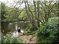
Looking upstream a backwater of the River Dee
At Pittengullies near Peterculter.
Image: © Stanley Howe
Taken: 14 Jun 2013
0.08 miles

4
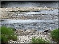
Herring Gulls on the Dee
At Peterculter, in mid-June.
Image: © Stanley Howe
Taken: 14 Jun 2013
0.13 miles
5
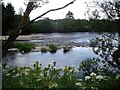
Gulls loafing on shingle in the River Dee
Upstream of where the river divides to pass both sides of two wooded islets. The water surface indicates different current speeds on either side of the islands.
Image: © Stanley Howe
Taken: 14 Jun 2013
0.14 miles
6
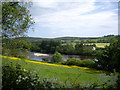
Shingle bank in the River Dee
Seen from close to a former bridge over the Old Deeside Railway at Pittengullies Circle.
Image: © Stanley Howe
Taken: 14 Jun 2013
0.14 miles
7
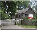
Access to Camphill School grounds
From Peterculter's 'Lovers Walk' at Pittengullies.
Image: © Stanley Howe
Taken: 14 Jun 2013
0.15 miles
8
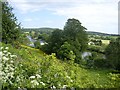
Looking downstream River Dee
From the Deeside Way near Pittengullies. Note the cottage on the south bank of the river (right), the shingle banks in the river (centre left) and the wooded island in the river (far left).
Image: © Stanley Howe
Taken: 14 Jun 2013
0.15 miles
9
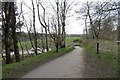
Deeside Way, Peterculter
A departure from the Deeside Railway trackbed due to a missing bridge over Pittengullies Brae.
Image: © Richard Webb
Taken: 4 Apr 2017
0.18 miles
10
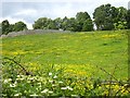
A flower meadow by the Dee
Looking up the brae from Lovers Walk path to an unidentified walled enclosure (on left). Since the former Deeside Railway used to run along the top of the brae - route marked by the line of trees - the enclosure may have had links with the railway. Indeed the map shows there to have been a short access bridge across the railtrack at that point, the stone abutments of which are still in place.
Image: © Stanley Howe
Taken: 14 Jun 2013
0.18 miles