Overview for Pandy, ABERGAVENNY, NP7 8DS
Introduction
Abergavenny is a market town and community in Monmouthshire, Wales. Abergavenny is promoted as a Gateway to Wales; it is approximately 6 miles (10 km) from the border with England and is located where the A40 trunk road and the A465 Heads of the Valleys road meet.
Originally the site of a Roman fort, Gobannium, it became a medieval walled town within the Welsh Marches. The town contains the remains of a medieval stone castle built soon after the Norman conquest of Wales.
Abergavenny is situated at the confluence of the River Usk and a tributary stream, the Gavenny. It is almost entirely surrounded by mountains and hills: the Blorenge (559 m, 1,834 ft), the Sugar Loaf (596 m, 1,955 ft), Ysgyryd Fawr (Great Skirrid), Ysgyryd Fach (Little Skirrid), Deri, Rholben and Mynydd Llanwenarth, known locally as "Llanwenarth Breast". Abergavenny provides access to the nearby Black Mountains and the Brecon Beacons National Park. The Marches Way and Beacons Way pass through Abergavenny whilst the Offa's Dyke Path passes through Pandy five miles to the north and the Usk Valley Walk passes through nearby Llanfoist.
In the UK 2011 census, the six relevant wards (Lansdown, Grofield, Castle, Croesonen, Cantref and Priory) collectively listed Abergavenny's population as 12,515. The town hosted the 2016 National Eisteddfod of Wales.
Summary for Pandy, ABERGAVENNY, NP7 8DS
Roadworks near NP7 8DS
A local roadworks feed is not available for Wales at this time.
However, Traffic Wales/Traffig Cymru provide works details for motorways and major trunk roads in Wales on their website at traffic.wales/roadworks
Road Safety near NP7 8DS
Details of personal injury accidents in and around NP7 8DS that have been reported to Gwent Police over the past 20 years.
Traffic Levels near NP7 8DS
View traffic levels near NP7 8DS from official Department for Transport counts.
Images taken in and around the np78ds area
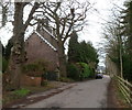
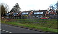
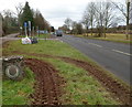
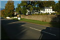
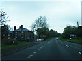
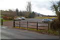
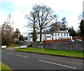
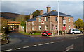
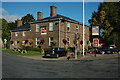
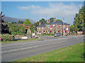
Please click the More button for more images, licensing and image copyright information.
Abergavenny and nearby Videos From YouTube
Abergavenny Castle
Abergavenny Castle spot visit. Learn more about the massacre at ...
Channel: GeoAble SD (View Channel)
Published: 14 Jun 2018
Member of UK Parliament
This postcode is in the Monmouth parliamentary constituency.
Monmouth is a constituency in Wales. The seat has been held by David T C Davies (Conservative) since May 2010.

Most Recent House Sales for NP7 8DS
19 Sep 2019
9 Oct 2017
5 Apr 2013
20 Jun 1997
Local Petrol Station Prices
Coordinates for NP7 8DS
Residents at NP7 8DS
Sunrise and Sunset at NP7 8DS
Traffic Emission and Congestion Zones
Historical Weather Summary
| Clear | 18.83% |
| Cloudy | 68.61% |
| Rain | 7.09% |
| Windy | 5.20% |
| Other | 0.27% |
Population
Deprivation Index
the more deprived the postcode
Average Energy Performance
Companies Registered at NP7 8DS
Postcode Details for NP7 8DS
Recent Updates
|
18 Apr 2024 Added Traffic Camera Views from Traffic Scotland to Roadworks within Scotland |
|
15 Apr 2024 Schools Data updated for April 2024 |
|
10 Apr 2024 Companies Data updated for March 2024 |
|
7 Apr 2024 New option to receive automatic updates to roadworks that affect you |
|
7 Apr 2024 Police and Crime data updated for February 2024 |
|
3 Apr 2024 Sold House Price data updated for February 2024 |
|
30 Mar 2024 Energy Performance Certificates (England and Wales) updated February 2024 |
|
28 Mar 2024 New feature to use Geolocating functions to detect your current location |
Random Postcodes
Want an idea of what is in our extensive website? Try somewhere completely random!
The Rural/Urban classification is based upon data collected during the 2011 Census and released in August 2013 and is categorised into 6 distinct classes.
[A] Urban Major conurbation: A built up area with a population of 10,000 (3,000 in Scotland) or more and is assigned to the major conurbation settlement category.
[B] Urban Minor conurbation: A built up area with a population of 10,000 (3,000 in Scotland) or more and is assigned to the minor conurbation settlement category.
[C] Urban City and town: A built up area with a population of 10,000 (3,000 in Scotland) or more and is assigned to the city and town settlement category.
[D] Rural Town and fringe
[E] Rural Village
[F] Rural Hamlet and isolated dwelling
The Index of Multiple Deprivation (IMD) is the official measure of relative deprivation.
The index is based on 39 separate indicators across seven distinct domains (Income; Employment; Health and Disability; Education, Skills and Training; Crime; Barriers to Housing and Services; Living Environment) to provide an overall measure of multiple deprivation and is calculated for every neighbourhood.
The index is relative rather than an absolute scale and so a neighbourhood with a score of 10 is more deprived than one rated 20, but this does not equate to being twice as deprived.
Please note: Different indices are used in England, Scotland, Wales and Northern Ireland and so comparison of scores from neighbourhoods in different countries should not be undertaken.
These figures report on incorporated UK companies only that are registered at this postcode and do not include sole-traders, partnerships or overseas organisations.
The population figure shown for your area are an estimate provided by the Office for National Statistics and is rounded to the nearest 1,000.
The estimates are derived from the Annual Population Survey (APS) which is the Labour Force Survey (LFS) plus various sample boosts.
There are 55 unitary authorities. They provide all local government services in their areas. These are mainly in the cities, urban areas and larger towns although there are now 6 shire county councils that are unitary (ie have no district councils beneath them).