IMAGES TAKEN NEAR TO
Lockington, DRIFFIELD, YO25 9SX
Introduction
This page details the photographs taken nearby to YO25 9SX by members of the Geograph project.
The Geograph project started in 2005 with the aim of publishing, organising and preserving representative images for every square kilometre of Great Britain, Ireland and the Isle of Man.

There are currently over 7.5m images from over14,400 individuals and you can help contribute to the project by visiting https://www.geograph.org.uk
Image Map
Images are licensed for reuse under creativecommons.org/licenses/by-sa/2.0
Notes
- Clicking on the map will re-center to the selected point.
- The higher the marker number, the further away the image location is from the centre of the postcode.
Image Listing (10 Images Found)
Images are licensed for reuse under creativecommons.org/licenses/by-sa/2.0
Image
Details
Distance
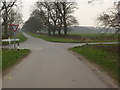
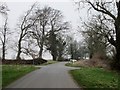
2
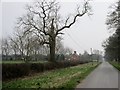
Road south to the B1248
Typical of the long straight roads on the Yorkshire Wolds.Grange Cottages and Lockington Grange Farm to the left.
Image: © Martin Dawes
Taken: 17 Mar 2015
0.05 miles
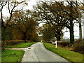
4
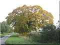
Autumn colour on the lane to Lockington
Image: © Jonathan Thacker
Taken: 20 Oct 2012
0.18 miles
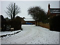
5
Country Lane Near Lockington
Walking Eastwards towards Lockington
Image: © Ian Lavender
Taken: 27 Sep 2005
0.19 miles
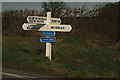
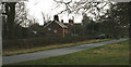
6
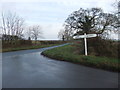
Country crossroads looking towards Lockington
Image: © David Brown
Taken: 22 Dec 2019
0.19 miles
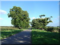
7
Country roads crossroads
Just north of Lockington Grange Farm
Image: © Martin Dawes
Taken: 17 Mar 2015
0.19 miles