IMAGES TAKEN NEAR TO
Dunnington, DRIFFIELD, YO25 8EQ
Introduction
This page details the photographs taken nearby to YO25 8EQ by members of the Geograph project.
The Geograph project started in 2005 with the aim of publishing, organising and preserving representative images for every square kilometre of Great Britain, Ireland and the Isle of Man.

There are currently over 7.5m images from over14,400 individuals and you can help contribute to the project by visiting https://www.geograph.org.uk
Image Map
Images are licensed for reuse under creativecommons.org/licenses/by-sa/2.0
Notes
- Clicking on the map will re-center to the selected point.
- The higher the marker number, the further away the image location is from the centre of the postcode.
Image Listing (13 Images Found)
Images are licensed for reuse under creativecommons.org/licenses/by-sa/2.0
Image
Details
Distance
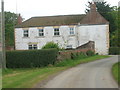
1
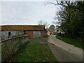
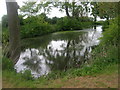
Billings Hill farm and houses
On a country lane to Dunnington
Image: © Martin Dawes
Taken: 3 Nov 2022
0.02 miles
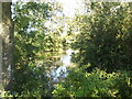
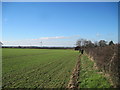
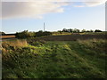
7
Farmland and wood north of Billings Hill
Image: © Martin Dawes
Taken: 3 Nov 2022
0.14 miles
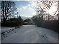
8
Site of Water Tower now dismantled
Still shown on OS maps
Image: © Martin Dawes
Taken: 27 Feb 2013
0.17 miles
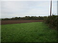
9
Farmland near Dunnington
Looking towards Billings Hill.
Image: © Jonathan Thacker
Taken: 5 Oct 2017
0.17 miles
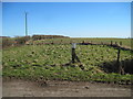
10
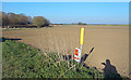
Gas Marker, Billings Lane
Most of TA1451 is fields with a short length of Billings Lane in the south east corner being the only access.
Image: © Des Blenkinsopp
Taken: 25 Mar 2020
0.20 miles