
IMAGES TAKEN NEAR TO
Inghams Close, WHITBY, YO22 5EJ
Introduction
This page details the photographs taken nearby to Inghams Close, YO22 5EJ by members of the Geograph project.
The Geograph project started in 2005 with the aim of publishing, organising and preserving representative images for every square kilometre of Great Britain, Ireland and the Isle of Man.

There are currently over 7.5m images from over14,400 individuals and you can help contribute to the project by visiting https://www.geograph.org.uk
Image Map
Images are licensed for reuse under creativecommons.org/licenses/by-sa/2.0
Notes
- Clicking on the map will re-center to the selected point.
- The higher the marker number, the further away the image location is from the centre of the postcode.
Image Listing (46 Images Found)
Images are licensed for reuse under creativecommons.org/licenses/by-sa/2.0
Image
Details
Distance
1
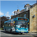
Arriva arrives in Sleights
The 95 service runs from Whitby to Sleights, so no need to negotiate the 20% gradient of Blue Bank.
Image: © Pauline E
Taken: 16 Aug 2013
0.01 miles
2
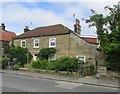
Midge Hall
A grade II listed building, said to have been The Red Lion Inn, now two dwellings. Inset datestone over the door inscribed: MIDGE HALL 1819
LBS No:- 327529
Image: © Mike Kirby
Taken: 14 Jun 2014
0.02 miles
3
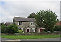
Ivy Cottage
A typical stone built cottage, the likes of which can be found all over North Yorkshire.
Image: © Mike Kirby
Taken: 14 Jun 2014
0.02 miles
4
Coach Road
Travelling along the western side of Sleights on the A169 as we drive towrds Whitby.
Image: © Malcolm Neal
Taken: 24 Jul 2021
0.03 miles
5
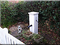
Pump alongside Coach Road, Sleights
This pump was, according to the parish council's website, erected in 1859 to replace a traditional well and bucket, and was last used in 1930.
Image: © Stephen Craven
Taken: 13 Jan 2019
0.04 miles
6
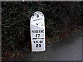
Milepost in Sleights
A cast iron milepost of the 19th century, giving the distances to Whitby (4 miles) and in the other direction to Pickering (17) and Malton (25). Listed grade II (list entry 1173853).
Image: © Stephen Craven
Taken: 13 Jan 2019
0.04 miles
7
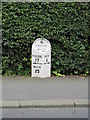
Milepost
A grade II listed milepost in cast iron, dated late C19.
LBS No:- 327530
Image: © Mike Kirby
Taken: 14 Jun 2014
0.04 miles
8
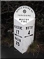
Old Milepost by the A169, Coach Road, Sleights
Cast iron post by the A169, in parish of ESKDALESIDE CUM UGGLEBARNBY (SCARBOROUGH District), Coach Road, Sleights; 100m North of Road Junction sign, by the road, on East side of road. Bedale rose iron casting, erected by the District Council in the 19th/20th century.
Inscription reads:-
: PICKERING / 17 / {arrow} / MALTON / 25 : : NORTH RIDING OF / {rose} / YORKSHIRE / WHITBY / RDC : : WHITBY / 4 / {arrow} :
Maker:-
: F MATTISON & Co / BEDALE. :
Grade II listed. List Entry Number: 1173853
https://historicengland.org.uk/listing/the-list/list-entry/1173853
Milestone Society National ID: YN_PIWY17a.
Image: © C Minto
Taken: 20 Oct 2004
0.05 miles
9
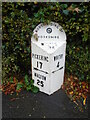
Old milepost
Eight miles north of the last NRYCC milepost is the next one which is on the main road through Sleights, Coach Road, A169. So still on the line of the Whitby to Middleton (Pickering) tollroad. It is 100m north of a Road Junction sign. Well looked-after with the WHITBY/RDC on the bevel needing painting.
Image: © Chris Minto
Taken: 19 Oct 2023
0.05 miles
10
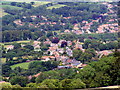
Sleights . North Yorkshire
Sleights , North Yorkshire , the photograph was take from an abandoned quarry South of the village .
Image: © DTwigg
Taken: 23 Jun 2011
0.09 miles