Old milepost
Introduction
The photograph on this page of Old milepost by Chris Minto as part of the Geograph project.
The Geograph project started in 2005 with the aim of publishing, organising and preserving representative images for every square kilometre of Great Britain, Ireland and the Isle of Man.

There are currently over 7.5m images from over 14,400 individuals and you can help contribute to the project by visiting https://www.geograph.org.uk
Old milepost
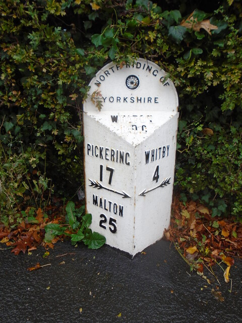
Image: © Chris Minto Taken: 19 Oct 2023
Eight miles north of the last NRYCC milepost is the next one which is on the main road through Sleights, Coach Road, A169. So still on the line of the Whitby to Middleton (Pickering) tollroad. It is 100m north of a Road Junction sign. Well looked-after with the WHITBY/RDC on the bevel needing painting.
Images are licensed for reuse under creativecommons.org/licenses/by-sa/2.0
Image Location
Latitude
54.452187
Longitude
-0.665546