IMAGES TAKEN NEAR TO
Frobisher Drive, WHITBY, YO21 1NX
Introduction
This page details the photographs taken nearby to Frobisher Drive, YO21 1NX by members of the Geograph project.
The Geograph project started in 2005 with the aim of publishing, organising and preserving representative images for every square kilometre of Great Britain, Ireland and the Isle of Man.

There are currently over 7.5m images from over14,400 individuals and you can help contribute to the project by visiting https://www.geograph.org.uk
Image Map
Images are licensed for reuse under creativecommons.org/licenses/by-sa/2.0
Notes
- Clicking on the map will re-center to the selected point.
- The higher the marker number, the further away the image location is from the centre of the postcode.
Image Listing (52 Images Found)
Images are licensed for reuse under creativecommons.org/licenses/by-sa/2.0
Image
Details
Distance
1
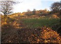
Hillside above Esk Valley Walk
From the top of Fitts Steps, as shown in Image, looking to the right up the side of the Esk valley across heath and bushes.
Image: © Derek Harper
Taken: 30 Dec 2012
0.14 miles
2

Housing on the edge of Whitby (1)
The houses at the top of the hill are on Pembroke Way, Whitby. The one house at the bottom of the slope is The Range, effectively in the outlying village of Ruswarp and reached by a long private drive.
Image: © Stephen Craven
Taken: 12 Jan 2019
0.15 miles
4
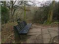
Bench and signpost
At the top of Fitts Steps Image, there is a choice of two routes towards Whitby.
Image: © Stephen Craven
Taken: 12 Jan 2019
0.16 miles
5
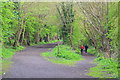
Former Prospect Hill railway junction
The line on the right curved down steeply to Whitby Town, while that on the left was the route to Scarborough.
Image: © David Martin
Taken: 18 Apr 2017
0.17 miles
6
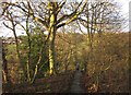
Fitts Steps
The Esk Valley Walk follows footpath 30 23/28/3 down this stone trod onto the Esk flood plain. The settlement ahead is Ruswarp.
Image: © Derek Harper
Taken: 30 Dec 2012
0.17 miles
7
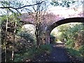
Bridge over the old railway line
This bridge is interesting as it not only crosses the former Whitby to Scarborough railway track, but to the left it also crosses a branch which once dropped down the hillside to connect with the Esk Valley line which still runs into the current Whitby railway station.
Image: © Gordon Hatton
Taken: 6 Nov 2017
0.17 miles
8
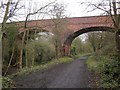
Bridge over Cinder Track
This fine brick viaduct crosses the lines of two former railways, including the former Scarborough and Whitby line (NCN1). It now seems to carry just a path.
Image: © Derek Harper
Taken: 31 Dec 2012
0.17 miles
9
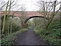
Bridge over two disused railways
This magnificent bridge only carries a field access track (currently disused). The railway track on the left is gradually climbing to meet the main line, which is now part of the North Sea Cycle Route, NCN1.
Image: © Humphrey Bolton
Taken: 25 Dec 2012
0.17 miles