IMAGES TAKEN NEAR TO
Hawthorn Close, MALTON, YO17 7AF
Introduction
This page details the photographs taken nearby to Hawthorn Close, YO17 7AF by members of the Geograph project.
The Geograph project started in 2005 with the aim of publishing, organising and preserving representative images for every square kilometre of Great Britain, Ireland and the Isle of Man.

There are currently over 7.5m images from over14,400 individuals and you can help contribute to the project by visiting https://www.geograph.org.uk
Image Map
Images are licensed for reuse under creativecommons.org/licenses/by-sa/2.0
Notes
- Clicking on the map will re-center to the selected point.
- The higher the marker number, the further away the image location is from the centre of the postcode.
Image Listing (17 Images Found)
Images are licensed for reuse under creativecommons.org/licenses/by-sa/2.0
Image
Details
Distance
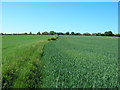
2
Rape beside Westgate Lane
Looking along Westgate Lane as it heads west from Old Malton.
Image: © DS Pugh
Taken: 14 May 2022
0.18 miles
3
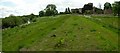
Old Malton Flood Defences
The bank in the middle of the shot is part of the new River Derwent flood defences for Old Malton. In the background is the tower of St Mary's Priory Church
Image: © Stuart and Fiona Jackson
Taken: 22 May 2005
0.19 miles
4
Walking the Howardian Hills and beyond #169
Rainbow Kennels.
Image: © Ian S
Taken: 28 Aug 2010
0.19 miles
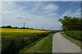
5
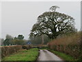
Westgate Lane
Narrow lane and bridle path heading west from Old Malton.
Image: © Gordon Hatton
Taken: 12 Dec 2021
0.20 miles
6
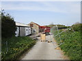
Rainbow Lane closed at Rainbow Farm
Image: © Jonathan Thacker
Taken: 22 Apr 2019
0.21 miles
7
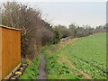
Field edge path, Old Malton
Footpath number 25.60/47 runs along the back of houses at Old Malton. The brick wall in the middle distance marks the boundary of the cemetery.
Image: © Gordon Hatton
Taken: 12 Dec 2021
0.21 miles
8

Walking the Howardian Hills and beyond #170
The Rainbow Equine Hospital.
Image: © Ian S
Taken: 28 Aug 2010
0.21 miles
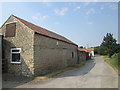
10
Walking the Howardian Hills and beyond #171
Rainbow Lane, Malton.
Image: © Ian S
Taken: 28 Aug 2010
0.22 miles