
IMAGES TAKEN NEAR TO
St. Johns Road, SCARBOROUGH, YO12 5EL
Introduction
This page details the photographs taken nearby to St. Johns Road, YO12 5EL by members of the Geograph project.
The Geograph project started in 2005 with the aim of publishing, organising and preserving representative images for every square kilometre of Great Britain, Ireland and the Isle of Man.

There are currently over 7.5m images from over14,400 individuals and you can help contribute to the project by visiting https://www.geograph.org.uk
Image Map
Images are licensed for reuse under creativecommons.org/licenses/by-sa/2.0
Notes
- Clicking on the map will re-center to the selected point.
- The higher the marker number, the further away the image location is from the centre of the postcode.
Image Listing (242 Images Found)
Images are licensed for reuse under creativecommons.org/licenses/by-sa/2.0
Image
Details
Distance
1
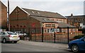
St John?s Road Methodist United Reformed Church
The photograph, which was taken from Image near its Image (a few metres to the right).
The white building on the right is situated on Rosevale Terrace and the houses beyond on Commercial Street.
Image: © Alan Walker
Taken: 9 Apr 2008
0.02 miles
2
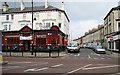
Commercial Street
This photograph shows the southern end of Commercial Street at its junction with Image
Behind the viewpoint and slightly to the right is the entrance to an alleyway, which in the 1950’s and 1960’s, was known locally as Image
The public house on the corner is ‘The Commercial.’
To see another photograph of Commercial Street, taken from its other end at its junction with Wykeham Street, click here Image
Road name information from OS Maps.
Image: © Alan Walker
Taken: 9 Apr 2008
0.04 miles
3
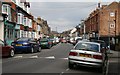
St John?s Road
The photograph, which was taken from near its Image (just behind the viewpoint), is looking north north-westerly along St John’s Road.
The railings on the right are the boundary with Image
For a more north north-westerly (ahead) photograph of St John's, click here Image
Road name information from OS Maps.
Image: © Alan Walker
Taken: 9 Apr 2008
0.04 miles
4
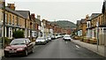
St John?s Road
The photograph, which was taken from near its junction with Image¹, is looking south south-easterly along St John’s Road¹ toward Falsgrave Road¹.
The hill in the distance is called Oliver’s Mount http://www.geograph.org.uk/photo/2239258 . The two structures on the hill are a communications transmitter (left) and the town's war memorial (right).
The junction on the right, ahead is with Image¹.
For a more south south-easterly (ahead) photograph of St John's Road but looking back, toward this viewpoint, click here Image
For a more north north-westerly (behind the viewpoint) photograph of St John’s Road, click here Image
¹ Road name information from OS Maps at:-
Elgin, http://www.elgin.gov.uk/
Image: © Alan Walker
Taken: 2 May 2007
0.05 miles
5
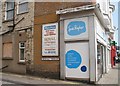
Rosevale Terrace
Rosevale Terrace is a small street running off Falsgrave Road which runs to the right. The advertisement for the Ward Price Royal Auction Rooms on the side of the Sue Ryder shop is somewhat out of date - the auction rooms closed about ten years ago.
Image: © Christopher Hall
Taken: 10 Sep 2014
0.05 miles
6
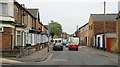
Commercial Street
Off the western (left) end of Image and opposite the junction with Image, the photograph is looking south-easterly along Commercial Street toward Falsgrave.
The lone tree is near the site of damage caused during the Second World War when, on 18th March 1941, Commercial Street was struck by a parachute mine, killing seven and injuring many others (Scarborough in the 1930s and ’40s by Richard James Percy – ISBN 0 860767 134 8). http://www.genuki.org.uk/big/eng/YKS/Misc/Military/TheScarboroughWarYears.pdf (Use your browser to search several times for: Commercial Street)
http://www.bbc.co.uk/ww2peopleswar/stories/84/a3855684.shtml (Use your browser to search twice for: Commercial Street)
http://www.genuki.org.uk/big/eng/Indexes/NE_WarDead/CWD_W-Y.html#W (Use your browser to search for: Willis, Sylvia & Waller, Joan)
http://www.genuki.org.uk/big/eng/Indexes/NE_WarDead/CWD_H-I.html (Use your browser to search for: Hodgson, Elizabeth & Hall, Alan & Hall, Lavinia & Hall, Sheila & Heseltine, Mary Jane)
In the 1950's the building on the left-hand edge of the photograph used to be a corner shop.
To see another photograph of Commercial Street, taken from its other end at its junction with Falsgrave Road, click here Image
Road name information from OS Maps at:-
Elgin, http://www.elgin.gov.uk/
Image: © Alan Walker
Taken: 2 May 2007
0.06 miles
7
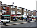
Spar shop and Post Office
On Falsgrave Road, Scarborough.
Image: © JThomas
Taken: 20 Feb 2016
0.06 miles
8
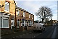
Commercial Street, Scarborough
Commercial Street is a 19th century street of largely 'bye-law' housing though there are commercial uses. In 1941, about 15 terrace houses were damaged by a heavy bomb and had to be demolished. In the 1950s Tarren type prefabricated bungalows were put up to replace them, three of which still exist. Recently some of the prefabs have been replaced by the brick built residences behind the white van and one has been removed to create a pedestrian access to the Sainsbury's superstore.
79 Commercial Street, which was one of those demolished after 1941, had also been damaged during the German bombardment of Scarborough on December 16th 1914 but had been renovated at that time.
Image: © Christopher Hall
Taken: 10 Jan 2014
0.06 miles
9

Falsgrave Road
This west south-westerly facing photograph was taken from the pedestrian reservation on Falsgrave Road between its junction with Image (ahead, left) and Commercial Street (behind the viewpoint, right).
At the traffic lights ahead Falsgrave Road continues toward its junction with Scalby Road and Stepney Road whilst the road off to the left is Seamer Road Corner.
For a more west south-westerly (some 35 metres nearer the traffic lights and just beyond New Park Road) photograph of Falsgrave Road, click here Image
To the left of this viewpoint (approximately) there is this view of Image
For another photograph of Falsgrave Road, taken from approximately the same viewpoint but facing the opposite direction, click here Image
Road name information from OS Maps.
Image: © Alan Walker
Taken: 9 Apr 2008
0.06 miles
10
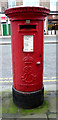
Edward VII postbox on Falsgrave Road, Scarborough
Postbox No. YO12 29.
See Image] for cypher.
See Image] for detail.
See Image] and Image] for context.
Image: © JThomas
Taken: 20 Feb 2016
0.07 miles