Commercial Street
Introduction
The photograph on this page of Commercial Street by Alan Walker as part of the Geograph project.
The Geograph project started in 2005 with the aim of publishing, organising and preserving representative images for every square kilometre of Great Britain, Ireland and the Isle of Man.

There are currently over 7.5m images from over 14,400 individuals and you can help contribute to the project by visiting https://www.geograph.org.uk
Commercial Street
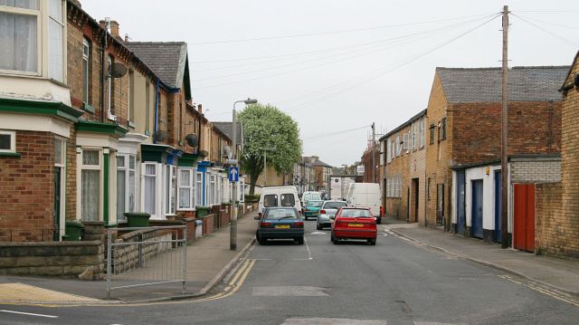
Image: © Alan Walker Taken: 2 May 2007
Off the western (left) end of Image and opposite the junction with Image, the photograph is looking south-easterly along Commercial Street toward Falsgrave. The lone tree is near the site of damage caused during the Second World War when, on 18th March 1941, Commercial Street was struck by a parachute mine, killing seven and injuring many others (Scarborough in the 1930s and ’40s by Richard James Percy – ISBN 0 860767 134 8). http://www.genuki.org.uk/big/eng/YKS/Misc/Military/TheScarboroughWarYears.pdf (Use your browser to search several times for: Commercial Street) http://www.bbc.co.uk/ww2peopleswar/stories/84/a3855684.shtml (Use your browser to search twice for: Commercial Street) http://www.genuki.org.uk/big/eng/Indexes/NE_WarDead/CWD_W-Y.html#W (Use your browser to search for: Willis, Sylvia & Waller, Joan) http://www.genuki.org.uk/big/eng/Indexes/NE_WarDead/CWD_H-I.html (Use your browser to search for: Hodgson, Elizabeth & Hall, Alan & Hall, Lavinia & Hall, Sheila & Heseltine, Mary Jane) In the 1950's the building on the left-hand edge of the photograph used to be a corner shop. To see another photograph of Commercial Street, taken from its other end at its junction with Falsgrave Road, click here Image Road name information from OS Maps at:- Elgin, http://www.elgin.gov.uk/
Images are licensed for reuse under creativecommons.org/licenses/by-sa/2.0
Image Location


Leaflet Map data © OpenStreetMap
Latitude
54.278468
Longitude
-0.414509