IMAGES TAKEN NEAR TO
Olivers Mount, SCARBOROUGH, YO11 2UG
Introduction
This page details the photographs taken nearby to Olivers Mount, YO11 2UG by members of the Geograph project.
The Geograph project started in 2005 with the aim of publishing, organising and preserving representative images for every square kilometre of Great Britain, Ireland and the Isle of Man.

There are currently over 7.5m images from over14,400 individuals and you can help contribute to the project by visiting https://www.geograph.org.uk
Image Map
Images are licensed for reuse under creativecommons.org/licenses/by-sa/2.0
Notes
- Clicking on the map will re-center to the selected point.
- The higher the marker number, the further away the image location is from the centre of the postcode.
Image Listing (22 Images Found)
Images are licensed for reuse under creativecommons.org/licenses/by-sa/2.0
Image
Details
Distance
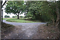
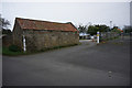
1
Oliver's Mount Farm and the road to the top of Oliver's Mount
Image: © Phil Catterall
Taken: 4 Oct 2006
0.01 miles
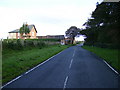
2
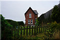
Oliver's Mount Farm
The farmhouse built in 1897 at Oliver's Mount Farm, just west of the hairpin bend at the southern end of Jackson's Lane.
Image: © Paul Glazzard
Taken: 15 Aug 2008
0.01 miles
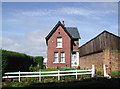
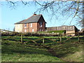
3
Oliver's Mount Farm
Just north of a tight hairpin bend on Jackson's Lane.
Image: © Pauline E
Taken: 21 Jul 2014
0.01 miles
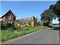
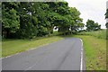
4
Oliver's Mount Farm, Jackson Lane, Oliver's Mount
Image: © Ian S
Taken: 26 Sep 2018
0.01 miles
8
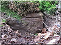
Bench mark in Jackson's Lane quarry, Oliver's Mount
This Ordnance Survey bench mark was covered by moss on the southern edge of the large former quarry in Jackson's Lane, below Oliver's Mount. The mark first appears on the 1967-8 O.S. map, so is not very old. See also Image
Image: © John S Turner
Taken: 7 May 2017
0.05 miles
9
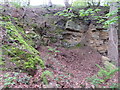
Sandstone quarry in Jackson's Lane, below Oliver's Mount
A disused sandstone quarry in Jackson's Lane. There is an Ordnance Survey bench mark cut into the stone at the bottom of the moss line on the left of the photo - Image
Image: © John S Turner
Taken: 7 May 2017
0.05 miles