IMAGES TAKEN NEAR TO
Birch Grove, BRIDGNORTH, WV15 6JZ
Introduction
This page details the photographs taken nearby to Birch Grove, WV15 6JZ by members of the Geograph project.
The Geograph project started in 2005 with the aim of publishing, organising and preserving representative images for every square kilometre of Great Britain, Ireland and the Isle of Man.

There are currently over 7.5m images from over14,400 individuals and you can help contribute to the project by visiting https://www.geograph.org.uk
Image Map
Images are licensed for reuse under creativecommons.org/licenses/by-sa/2.0
Notes
- Clicking on the map will re-center to the selected point.
- The higher the marker number, the further away the image location is from the centre of the postcode.
Image Listing (13 Images Found)
Images are licensed for reuse under creativecommons.org/licenses/by-sa/2.0
Image
Details
Distance
2
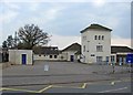
Alveley Community Primary School, Daddlebrook Road
The unusual three storey building appears to be much older then the rest of the school buildings.
Image: © P L Chadwick
Taken: 18 Apr 2010
0.14 miles
3
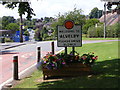
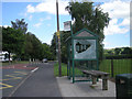
Alveley Welcome
The view in the Shropshire Village of Alveley.
Image: © Gordon Griffiths
Taken: 3 Aug 2013
0.15 miles
4
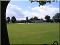
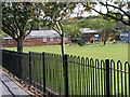
Village Cricket Pitch
The view of the Cricket Club founded in 1908 in the Shropshire Village of Alveley.
Image: © Gordon Griffiths
Taken: 3 Aug 2013
0.18 miles
5
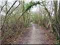
Byway towards Lake House
Either end of the track there is a solid, well made surface. Not so in the middle, where it runs along the bed of the Daddlebrook for quite a distance.
Image: © Richard Law
Taken: 3 Dec 2017
0.19 miles
6
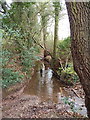
Cleaning Daft Dog up a bit
The byway runs along the Daddlebrook stream for a hundred yards or so here, fortunately with a footpath on the far bank for walkers. Daft Dog, coated in mud, needed little encouragement to go for a swim, which cleaned him up no end.
Image: © Richard Law
Taken: 3 Dec 2017
0.19 miles
7
Village Playground
The view in the Shropshire Village of Alveley.
Image: © Gordon Griffiths
Taken: 3 Aug 2013
0.22 miles
8
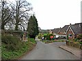
Minor road to the Buttercross
This road forms a long loop that leads back to the village, serving various farms and houses on its route. It also passes the well-known Buttercross, about two miles out of the village.
Image
Image: © P L Chadwick
Taken: 18 Apr 2010
0.22 miles
9
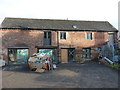
Barn conversions in progress
At the rear (just to the north) of Image, but not listed in its own right, this former cart barn now appears to be in the process of conversion to residential use.
Image: © Richard Law
Taken: 3 Dec 2017
0.22 miles
10
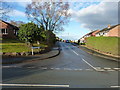
Holmes Orchard
An estate of probably 1980s housing, built on what was presumably an old apple orchard.
Image: © Richard Law
Taken: 3 Dec 2017
0.23 miles