
IMAGES TAKEN NEAR TO
Leacroft Avenue, WOLVERHAMPTON, WV10 9DA
Introduction
This page details the photographs taken nearby to Leacroft Avenue, WV10 9DA by members of the Geograph project.
The Geograph project started in 2005 with the aim of publishing, organising and preserving representative images for every square kilometre of Great Britain, Ireland and the Isle of Man.

There are currently over 7.5m images from over14,400 individuals and you can help contribute to the project by visiting https://www.geograph.org.uk
Image Map
Images are licensed for reuse under creativecommons.org/licenses/by-sa/2.0
Notes
- Clicking on the map will re-center to the selected point.
- The higher the marker number, the further away the image location is from the centre of the postcode.
Image Listing (41 Images Found)
Images are licensed for reuse under creativecommons.org/licenses/by-sa/2.0
Image
Details
Distance
1
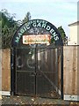
The Magic Garden, Bushbury
The secrets of the Magic Garden remain undiscovered as the gates were locked tight!
Image: © John M
Taken: 5 Nov 2006
0.08 miles
2
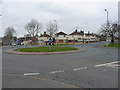
Roundabout in Bushbury
A roundabout on the Low Hill estate, at the junction of Whitgreave Avenue with Dickinson and Leacroft Avenues.
Image: © Richard Law
Taken: 16 Mar 2012
0.13 miles
3
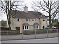
Council Housing - Old Fallings Lane
Concrete houses dating from late 1920s.
Image: © John M
Taken: 27 Mar 2011
0.14 miles
4
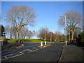
Top of Leacroft Avenue, Bushbury Hill estate
For many years, this junction, where Leacroft Avenue (foreground) meets Old Fallings Lane, was used by buses to turn round. The Bushbury Hill trolleybus service (latterly numbered 3) approached via Leacroft Avenue, though by the time buses stopped turning here, the equivalent service (by then numbered 598) had been rerouted to approach via Old Fallings Lane. The current route linking Bushbury Hill with Wolverhampton city centre, service 2, operates a one way loop around the estate and thus no longer needs to turn here.
Image: © Richard Vince
Taken: 28 Dec 2016
0.14 miles
5

lsland View
The view of a roundabout in Bushbury, Wolverhampton.
Image: © Gordon Griffiths
Taken: 16 Jun 2025
0.15 miles
6
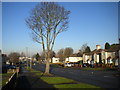
Bare tree on Kempthorne Avenue, Bushbury Hill estate
Looking down the hill towards Bushbury Lane.
Image: © Richard Vince
Taken: 28 Dec 2016
0.16 miles
7
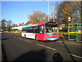
Bus on Old Fallings Lane, Bushbury Hill estate (2)
National Express West Midlands 2010, a Volvo B7RLE/Wrightbus Eclipse Urban 2, waits at the nominal terminus of route 2 (for which it carries route branding) before heading back to Warstones estate via Wolverhampton city centre.
Image: © Richard Vince
Taken: 28 Dec 2016
0.17 miles
8
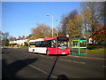
Bus on Old Fallings Lane, Bushbury Hill estate (1)
National Express West Midlands 2026, a Volvo B7RLE/Wrightbus Eclipse Urban 2, waits at the nominal terminus of route 2 before heading back to Warstones estate via Wolverhampton city centre.
Image: © Richard Vince
Taken: 28 Dec 2016
0.17 miles
9
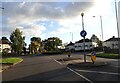
Kempthorne Avenue Island
The view in Bushbury, Wolverhampton.
Image: © Gordon Griffiths
Taken: 4 Nov 2021
0.17 miles
10
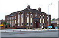
The New Highcroft, Old Fallings, Wolverhampton
The pub was originally the "Highcroft". This was changed to "The Moon Under Water" when new management was introduced. The pub's name was changed yet again to "The New Highcroft" when more new management was introduced.
The pub was put up for sale for £600,000 in February 2010 "subject to an occupational tenancy until 2011 at the (then) current rent of £18,302 per annum."
Update: This pub has been closed, sold, and is to be demolished in 2011 so that a new care home can be built.
Update 6 April 2011 Image
Image: © Roger Kidd
Taken: 7 Jun 2007
0.17 miles