
IMAGES TAKEN NEAR TO
Wolverhampton Road, WOLVERHAMPTON, WV10 7LU
Introduction
This page details the photographs taken nearby to Wolverhampton Road, WV10 7LU by members of the Geograph project.
The Geograph project started in 2005 with the aim of publishing, organising and preserving representative images for every square kilometre of Great Britain, Ireland and the Isle of Man.

There are currently over 7.5m images from over14,400 individuals and you can help contribute to the project by visiting https://www.geograph.org.uk
Image Map
Images are licensed for reuse under creativecommons.org/licenses/by-sa/2.0
Notes
- Clicking on the map will re-center to the selected point.
- The higher the marker number, the further away the image location is from the centre of the postcode.
Image Listing (16 Images Found)
Images are licensed for reuse under creativecommons.org/licenses/by-sa/2.0
Image
Details
Distance
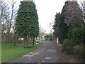
2
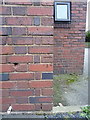
OS benchmark - Laney Green, The Wheatsheaf
An OS cutmark on the wall of Image originally levelled in 1963 at 133.411m above Ordnance Datum Newlyn.
Image: © Richard Law
Taken: 25 Feb 2016
0.05 miles
3
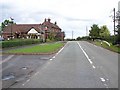
The Wheatsheaf, Wedges Mills
Once a busy pub situated on the A460 from the M6 to Cannock, the pub is now in a cul-de-sac but has managed to retain a good following.
Image: © Geoff Pick
Taken: 19 Oct 2006
0.06 miles
4
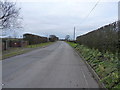
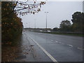
The former Wolverhampton Road
Once a part of the main A460 route between Wolverhamnpton and Cannock, the construction of the Birmingham Northern Relief Road (M6 Toll) in 2002 consigned this to be forever a dead-end backwater.
Image: © Richard Law
Taken: 25 Feb 2016
0.10 miles
6
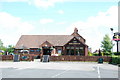
The Wheatsheaf, Wolverhampton Road
This part of the Wolverhampton road was the main road from Cannock to Wolverhampton until it was bypassed when the M6 Toll road and dual carriageway were built, and now it is only a dead end road.
Image: © Mick Malpass
Taken: 11 Jun 2011
0.13 miles
7
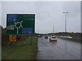
Approaching roundabout on the A460, Laney Green
Junction 11 on the M6 Motorway.
Image: © JThomas
Taken: 9 Nov 2019
0.13 miles
8
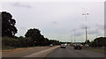
Large lay by on A460 north of M6 junction 11
Image: © John Firth
Taken: 5 Jul 2015
0.14 miles
9
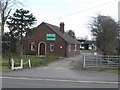
The Hollies Poultry Farm
With the construction of the M6 Toll and diversion of the A460 businesses on the old road such as this in Laney Green lost their passing trade.
Image: © John M
Taken: 24 Mar 2008
0.15 miles
10
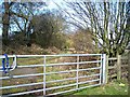
Bridle path and farm track
Runs under the M6 Toll Road and comes out at Saredon Hall Farm.
Image: © Antony Dixon
Taken: 18 Mar 2013
0.15 miles