
IMAGES TAKEN NEAR TO
Ellerton Walk, WOLVERHAMPTON, WV10 0UG
Introduction
This page details the photographs taken nearby to Ellerton Walk, WV10 0UG by members of the Geograph project.
The Geograph project started in 2005 with the aim of publishing, organising and preserving representative images for every square kilometre of Great Britain, Ireland and the Isle of Man.

There are currently over 7.5m images from over14,400 individuals and you can help contribute to the project by visiting https://www.geograph.org.uk
Image Map
Images are licensed for reuse under creativecommons.org/licenses/by-sa/2.0
Notes
- Clicking on the map will re-center to the selected point.
- The higher the marker number, the further away the image location is from the centre of the postcode.
Image Listing (30 Images Found)
Images are licensed for reuse under creativecommons.org/licenses/by-sa/2.0
Image
Details
Distance
1
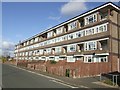
Council Housing - Valley Road
New Park Village was built in the 1970s replacing terraced housing in Park Village.
Image: © John M
Taken: 13 Nov 2010
0.05 miles
2
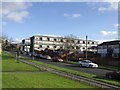
Council Housing - Shawbury Road
New Park Village was built in the 1970s replacing terraced housing in Park Village.
Image: © John M
Taken: 13 Nov 2010
0.06 miles
3
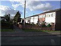
Council Housing - Valley Road
New Park Village was built in the 1970s replacing terraced housing in Park Village. The estate is a mix of flats and terraced housing.
Image: © John M
Taken: 13 Nov 2010
0.07 miles
4

Former Great Horse PH - Prestwood Road
Yet another local pub closure. This one has opened as a One-Stop convenience store. One Stop is a Tesco owned brand.
Image: © John M
Taken: 11 Mar 2012
0.12 miles
5

Council Housing - Flats in New Park Village
Flats built to replace properties demolished in nearby Park Village.
Image: © John M
Taken: 9 Sep 2006
0.13 miles
6
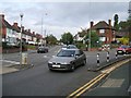
Parting of the ways
This junction on the Cannock Road in Wolverhampton dates back to the building of the turnpikes. The current Cannock Road to the left shortened the route by cutting off two sides of a triangle.
Image: © John M
Taken: 22 Sep 2007
0.17 miles
7
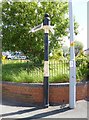
Old Direction Sign - Signpost by the A460, Cannock Road, Wolverhampton
Mushroom finial - 2 arms; Staffs CC mushroom by the A460, in parish of Wolverhampton (Wolverhampton District), Cannock Road, Fallings Park, at junction with Victoria Road, on pavement against wall.
Wolverhampton and Walsall HER.
HER Number: 13718 https://www.heritagegateway.org.uk/Gateway/Results_Single.aspx?uid=MBL5623&resourceID=1025
Surveyed
Milestone Society National ID: ST_SJ9200
Image: © Milestone Society
Taken: Unknown
0.17 miles
8
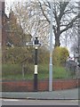
Cannock Road
The old turnpike road on the left was built cutting off a corner which is now preserved in the 20th century housing development. The road sign with a similar one at the other end of 'The Triangle' dates from the Staffordshire County Council period. The sign from pre 1902 is locally listed and was supplied by W H Smith of Whitchurch.
Image: © John M
Taken: 25 Dec 2008
0.17 miles
9
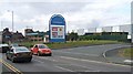
Warehousing on 'Meadows' Site
Henry Meadows Ltd was founded in 1920 to produce three speed gearboxes for cars. They quickly expanded into petrol and later diesel engines for military and commercial vehicles, boats and trains. In the 1950s the site covered an area of 14 acres with a workforce of 1200. The site closed in 1960 and had lain derelict for many years before the factory units were refurbished as warehousing.
A clothing manufacturer now occupies part of the original buildings.
Image: © John M
Taken: 22 Sep 2007
0.18 miles
10
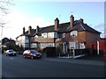
Fallings Park Garden Suburb - Victoria Road
This may have been the face of council housing in the town. An exhibition of housing was held on the Fallings Park 'Triangle' in 1908 with small groups of houses built around courts.
Image: © John M
Taken: 14 Jan 2011
0.18 miles